 Search: Madison
Filter: Categories of Wisconsin Historical Images
Filter: Year of 1900-1999
Filter: Year of 1900-1909
Filter: Year of 1900
Filter: Type of Map or Atlas
Search: Madison
Filter: Categories of Wisconsin Historical Images
Filter: Year of 1900-1999
Filter: Year of 1900-1909
Filter: Year of 1900
Filter: Type of Map or Atlas

| Date: | 1900 |
|---|---|
| Description: | This map shows the expansion of the University of Wisconsin-Madison campus growth between the years of 1850 and 1900. The map is indexed by building name a... |

| Date: | 1900 |
|---|---|
| Description: | A hydrographic map of Lake Monona and the adjacent topography. |

| Date: | 1900 |
|---|---|
| Description: | Hydrographic map of Lake Mendota and it's adjacent topography. Prepared from surveys made by civil engineering students, University of Wisconsin, classes 1... |
| Date: | 1900 |
|---|---|
| Description: | This map from the turn of the 20th century shows the township and range grid, sections, towns, land owned by the Starks Levis Land Company of Madison, scho... |

| Date: | 1900 |
|---|---|
| Description: | This map shows a proposed route of for a road linking military forts. The map also includes communities, lakes, and rivers. The map is accompanied by a rep... |
| Date: | 06 01 1900 |
|---|---|
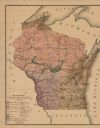
| Description: | This map shows the the locations of different kinds of clay and shales throughout the state of Wisconsin. Includes a colored legend of types of clay and sh... |
If you didn't find the material you searched for, our Library Reference Staff can help.
Call our reference desk at 608-264-6535 or email us at: