| Date: | 1987 |
|---|---|
| Description: | This 1987 map of Door County, Wisconsin, shows streets and roads, cities and villages, state parks, lakes and streams, and depths in Lake Michigan. A stree... |

| Date: | 1911 |
|---|---|
| Description: | Shows roads, railroads, street railways, abandoned logging railroads, rural mail routes, platted land, state forest reserves, and parts of Burnett County, ... |

| Date: | 1966 |
|---|---|
| Description: | This map from the 1960s provides a detailed street map of Milwaukee County and eastern Waukesha County as far west as Menomonee Falls and Muskego Lake. A p... |

| Date: | 1850 |
|---|---|
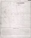
| Description: | This photocopied map shows lot and block numbers, selected buildings, street names and state lock located on the Fox River. Includes a description of Deper... |

| Date: | 1915 |
|---|---|
| Description: | This map shows roads, railroads, street railways, abandoned logging railroads, rural mail routes, telephone lines, schools, platted land, and state forest ... |

| Date: | 1976 |
|---|---|
| Description: | Includes index of streets and of local businesses. Shows location of Citizens State Bank, roads, highways, railroads, parks, cemeteries, and city sanitary ... |

| Date: | 1888 |
|---|---|
| Description: | Shows ward divisions and street railways, as well as University of Wisconsin buildings, churches, and schools. Cataloged from copy with right and left edge... |

| Date: | 06 1959 |
|---|---|
| Description: | This blue line print map shows lot and block numbers and dimensions, fair grounds, schools, court house, parks, and the street numbering system. The Crawfi... |

| Date: | 1953 |
|---|---|
| Description: | This map shows locations of State Medical Society, nine medical facilities, two University of Wisconsin buildings, four transportation centers, and five ho... |

| Date: | 1948 |
|---|---|
| Description: | Map created between 1948 and 1954. Shows businesses and lot owners around the State Capitol. Oriented with north to the upper right. Includes "continued in... |

| Date: | 1960 |
|---|---|
| Description: | Color coded map in pink, yellow, blue, and brown of Milwaukee County State and County trunk highways. The map includes a legend of symbols: "STEAM RAIL ROA... |

| Date: | 1933 |
|---|---|
| Description: | A road map of Wisconsin and Michigan’s Upper Peninsula, showing the populations of cities and villages, state and federal highways, national forests, state... |

| Date: | 1889 |
|---|---|
| Description: | This map shows a plat of city, city limits, numbered blocks, numbered lots, wards, local streets, roads, railroads, street railways, fire limits, hydrants,... |

| Date: | 1912 |
|---|---|
| Description: | This map shows counties, roads, Lake Superior, Lake Michigan, and a portion of Illinois, Iowa, Minnesota, and Michigan. Also included is a list of railroad... |

| Date: | 1938 |
|---|---|
| Description: | Color coded map in pink, yellow, blue, and brown of Milwaukee County State and County trunk highways. The map includes a legend of symbols: "STEAM RAIL ROA... |

| Date: | 1870 |
|---|---|
| Description: | Sauk City is the oldest incorporated village in Wisconsin (incorporated in 1854) and also has the oldest organized volunteer fire department in the state, ... |

| Date: | 1959 |
|---|---|
| Description: | This colored road map shows roads in Wisconsin as well as portions of nearby states. Information on the quality and type of any road shown (expressways, St... |

| Date: | 1893 |
|---|---|
| Description: | This map of La Crosse shows wards 1-20, streets, railroads, the Inter State Fair Grounds, islands, and the Mississippi River. Relief is shown by hachures. ... |

| Date: | 1890 |
|---|---|
| Description: | This map of Superior shows labeled streets, railroads, docks, city wards, and the state line. Relief is shown by hachures. Below the title reads: "Bedford ... |

| Date: | 1963 |
|---|---|
| Description: | This blue line print shows as of March 1960 federal, state, county, and town roads, as well as railroads, schools, churches, town hall, parks, and Brown Co... |
If you didn't find the material you searched for, our Library Reference Staff can help.
Call our reference desk at 608-264-6535 or email us at: