 Search: Wisconsin
Search: Department
Filter: Type of Map or Atlas
Search: Wisconsin
Search: Department
Filter: Type of Map or Atlas

| Date: | 06 1934 |
|---|---|
| Description: | This Wisconsin Conservation Department map shows national, state, and county forests both approved and pending, as well as Indian reservations in Wisconsin... |

| Date: | 04 1932 |
|---|---|
| Description: | This Wisconsin Conservation Department map shows federal, state, and county forest areas, the relative proportion of land owned by each agency, and state p... |

| Date: | 05 1935 |
|---|---|
| Description: | This Wisconsin Conservation Department map shows the locations of state forests, state nurseries, state parks, roadside parks, prison camps, and lookout to... |

| Date: | 1937 |
|---|---|
| Description: | This map shows the Wisconsin Conservation Department forest protection divisions and the locations of state forests, national forests, Indian reservations,... |

| Date: | 05 01 1938 |
|---|---|
| Description: | This map shows the locations of Wisconsin Conservation Department forest protection districts and cooperative areas, state forests, national forests, India... |

| Date: | 1937 |
|---|---|
| Description: | This Wisconsin Conservation Department map shows the locations of state forests, national forests, county forests, state nurseries, Indian reservations, st... |

| Date: | 1937 |
|---|---|
| Description: | This Wisconsin Conservation Department map shows the locations of game refuges, fish hatcheries, canning factories, fish camps, and fish refuges in the sta... |

| Date: | 1911 |
|---|---|
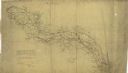
| Description: | This 1911 map from the U.S. Post Office Department shows rural delivery routes, active and discontinued post offices, selected rural landowners and houses,... |

| Date: | 1927 |
|---|---|
| Description: | These maps are compiled from existing maps created by the Joint Engineering Department, the Wisconsin Railroad, and the Tax Commissions. The maps include n... |

| Date: | 1937 |
|---|---|
| Description: | "Prepared ... March 1937." Includes location map. "State of Wisconsin, Conservation Department, Map Division"--upper left. From the E.P. Sherry papers rela... |

| Date: | 1929 |
|---|---|
| Description: | "Compliments of the Douglas County Highway Department"--Top margin. Shows state-trunk highways, county highways, town roads, trails, boundaries, and concr... |
| Date: | 1972 |
|---|---|
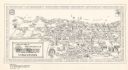
| Description: | This bird’s-eye-view map shows campus buildings labeled by name or academic department, local streets, and part of Lake Mendota. Relief is shown pictorial... |

| Date: | 1953 |
|---|---|
| Description: | "Compliments of the Douglas County Highway Department"--Top margin. Shows federal highways, state trunk highways, county highways, town roads, unimproved ... |

| Date: | 1969 |
|---|---|
| Description: | This Post Office Department map identifies post offices, summer post offices, rural stations, highway post offices, Post Office sectional centers, rural de... |

| Date: | 1886 |
|---|---|
| Description: | Wisconsin map showing land offices, railroads completed, railroad land grants and Indian reservations. |

| Date: | 1952 |
|---|---|
| Description: | This Wisconsin Conservation Dept. map shows sections, roads, rivers, and lakes in the Town of Cloverland, Vilas County, Wisconsin as of February, 1952. It ... |

| Date: | 1936 |
|---|---|
| Description: | This map of Neenah and Menasha shows some parks, churches, convention halls, and other buildings. These points of interest are in red ink. Streets, Little ... |
| Date: | 1864 |
|---|---|
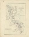
| Description: | This map of northwestern Georgia shows dates and troop positions between Chattanooga, Tennessee, and Jonesboro, Georgia, May-September, 1864. Wisconsin uni... |
| Date: | 1864 |
|---|---|
| Description: | Map of northwestern Georgia shows Union and Confederate troop positions between Chattanooga, Tenn., and Jonesboro, Ga., May-Sept., 1864. Wisconsin units in... |

| Date: | 1952 |
|---|---|
| Description: | This Wisconsin Conservation Dept. map shows sections, roads, rivers, and lakes in the Town of Presque Isle, Vilas County, Wisconsin as of March 1953. It do... |
If you didn't find the material you searched for, our Library Reference Staff can help.
Call our reference desk at 608-264-6535 or email us at: