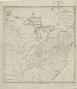
| Date: | 1795 |
|---|---|
| Description: | Map of the United States east of the Mississippi River. It features roads, cities, towns, early settlements, Native American land, forts, mountains, rivers... |

| Date: | 1780 |
|---|---|
| Description: | Detailed topographical and political map of the area from Lake Champlain to Albany and the Hudson River. Relief is shown through hachures. The map shows ci... |

| Fur Trader |
|---|
| Biography of John Lawe, a fur trader for Astor's American Fur Company in Green Bay. |

| Discover the story of French traders saved from starvation by Ottawa Indians at the headwaters of the Chippewa River in 1659. |

| How Native Life was Transformed |
|---|
| Discover how white contact disrupted and transformed Indian life in Wisconsin in the 17th and 18th centuries. |

| Learn about the history of Wisconsin between the years 1700-1749. |
If you didn't find the material you searched for, our Library Reference Staff can help.
Call our reference desk at 608-264-6535 or email us at: