 Search: increase
Search: lapham
Filter: Categories of Wisconsin Historical Images
Filter: Creator Name of Lapham, Increase Allen
Filter: Subject of formations (geology)
Search: increase
Search: lapham
Filter: Categories of Wisconsin Historical Images
Filter: Creator Name of Lapham, Increase Allen
Filter: Subject of formations (geology)

| Date: | 12 22 1830 |
|---|---|
| Description: | Increase Lapham's drawing of the geological profile between the Sandusky plains and Portsmouth, Ohio. |
| Date: | 1844 |
|---|---|
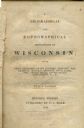
| Description: | Title page of Increase Lapham's A Geographical and Topographical Description of Wisconsin published by P.C. Hale of Milwaukee, Wisconsin. |

| Date: | 1866 |
|---|---|
| Description: | This manuscript map by Increase Lapham shows the Dells of the Wisconsin River, from Stand Rock and Witches Gulch at the north to a point approximately one ... |

| Date: | 1849 |
|---|---|
| Description: | Pencil sketch of a cross-section of the Dells of the Wisconsin River. People are in a row boat in the center. Caption at bottom: "The Dells — Wisconsin Riv... |

| Date: | 1867 |
|---|---|
| Description: | This 1867 manuscript map by Increase Lapham shows the topography and geology of the Blue Mounds region in the Town of Brigham in Iowa County and the towns ... |

| Date: | 1855 |
|---|---|
| Description: | This map shows counties, cities, rivers, canals, lakes, railroads, common roads, county towns, townships, villages, and post offices. The map includes part... |

| Date: | 1874 |
|---|---|
| Description: | This map of Wisconsin shows cities, counties, railroads already completed and railroads projected, and geological makeup of the land such as lakes. |

| Date: | 1869 |
|---|---|
| Description: | This geological map shows the township grid, counties, cities and villages, rivers, lakes, railroads, and roads. Barron County is still labeled Dallas Coun... |

| Date: | 1842 |
|---|---|
| Description: | This map shows portions of northern Illinois and Wisconsin surveyed by the map's creation. It shows county lines and university land, and depicts lead and ... |
If you didn't find the material you searched for, our Library Reference Staff can help.
Call our reference desk at 608-264-6535 or email us at: