 Search: increase
Search: lapham
Filter: Categories of Wisconsin Historical Images
Filter: Subject of intellectual life
Filter: Type of Drawing
Search: increase
Search: lapham
Filter: Categories of Wisconsin Historical Images
Filter: Subject of intellectual life
Filter: Type of Drawing

| Date: | 1828 |
|---|---|
| Description: | Drawing by Increase Lapham showing the geological profile of the land between Utica and Knob Creek, Kentucky at a scale of 1/2 inch to a mile. |
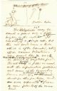
| Date: | 1876 |
|---|---|
| Description: | Page 11 of a speech written by Increase Lapham on embryonic development in plants. There are drawings at the top of the page. |

| Date: | 12 22 1830 |
|---|---|
| Description: | Increase Lapham's drawing of the geological profile between the Sandusky plains and Portsmouth, Ohio. |

| Date: | 1850 |
|---|---|
| Description: | Diagrams of four effigy mounds surveyed by Increase A. Lapham and W.H. Canfield in 1850. No. 1 is an unidentified animal shape, No. 2 consists of two linea... |

| Date: | 1837 |
|---|---|
| Description: | Copy of N.F. Hyer's original map of Aztalan as published in the Milwaukee Advertiser, February 25, 1837. |
If you didn't find the material you searched for, our Library Reference Staff can help.
Call our reference desk at 608-264-6535 or email us at: