Search: islands
Filter: Subject of land
Search: islands
Filter: Subject of land
| Date: | 1905 |
|---|---|
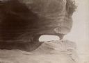
| Description: | Rock formation known as Trip Hannua Point on an Apostle Island. |

| Date: | |
|---|---|
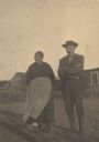
| Description: | A group of African American boys wearing hats on Johns Island. |
| Date: | |
|---|---|
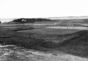
| Description: | Elevated view of golf links featuring Squaw Island in the distance. |

| Date: | 1910 |
|---|---|
| Description: | Photographic postcard view of "Helen's Isle" in a lake. |

| Date: | 1910 |
|---|---|
| Description: | A view from the water of Rocky Island on Rainy Lake. |
| Date: | 09 1971 |
|---|---|
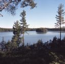
| Description: | Elevated view from forested hill towards Carrol Lake. |

| Date: | |
|---|---|
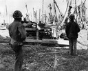
| Description: | Immigrants buying tickets at Ellis Island. |

| Date: | 1990 |
|---|---|
| Description: | This tourism brochure of Ashland County, Wisconsin, from the Ashland Area Chamber of Commerce includes a map of the county showing tourist destinations and... |
| Date: | 1944 |
|---|---|
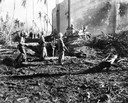
| Description: | Marines using an International TD-9 diesel TracTracTor (crawler tractor) and bulldozer to hunt Japanese soldiers on Namur, Kwajalein Atoll, Marshall Island... |
| Date: | 1944 |
|---|---|
| Description: | U.S. Marines searching for Japanese soldiers with an International TD-9 Diesel TracTracTor (crawler tractor) and bulldozer on Namur, Kwajalein Atoll, Marsh... |

| Date: | 1941 |
|---|---|
| Description: | This 1941 tourist map of Washington Island, Wisconsin, shows points of interest and places of business. Some information is shown pictorially. Rock, Hog, D... |

| Date: | 1907 |
|---|---|
| Description: | Aerial view of the Mississippi River with log rafts. |

| Date: | |
|---|---|
| Description: | Medical inspection of immigrants at Ellis Island. |
| Date: | |
|---|---|
| Description: | A drawing from Harney's "History of Winnebago County" of E.L. Mathewson's home on Doty Island. |

| Date: | 1769 |
|---|---|
| Description: | Manuscript map. Scale: about 80 British statue miles to 1 inch. |

| Date: | 1820 |
|---|---|
| Description: | A manuscript map of Prairie du Chien. |

| Date: | |
|---|---|
| Description: | Two children waiting for their parents at the Wadmalaw Citizenship School. |

| Date: | |
|---|---|
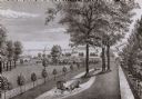
| Description: | Residences are shown on Main Street, exhibiting the colonial revival style. |

| Date: | 1683 |
|---|---|
| Description: | Map of the north east coast of North America showing islands, regions, Native American land, bays, and a few European settlements. The Great Lakes appear i... |
If you didn't find the material you searched for, our Library Reference Staff can help.
Call our reference desk at 608-264-6535 or email us at: