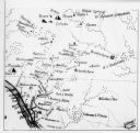
| Date: | 1829 |
|---|---|
| Description: | Map of lead mines operating in Wisconsin. |
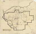
| Date: | 1920 |
|---|---|
| Description: | An ink on tracing paper, hand-drawn map that shows lead mines, the boundary of the lead bearing strata, and the military road in Lafayette, Grant, Iowa, an... |
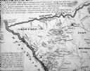
| Date: | 1829 |
|---|---|
| Description: | Photoprint of Crawford County lead district map. |
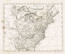
| Date: | 1800 |
|---|---|
| Description: | Map of the United States. It shows the states, including Tennessee, cities, towns, Native American land, mountains, lakes, and rivers. Lead mines appear ju... |
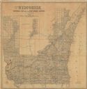
| Date: | 1850 |
|---|---|
| Description: | Mid and southern Wisconsin counties, city/town lines, lead mines, copper mines, streams, plank roads, and the Milwaukee and Mississippi Rail Roads. |
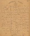
| Date: | 1836 |
|---|---|
| Description: | This early to mid-19th century map shows the township and range system, sections, landownership, furnaces, lead mines, copper mines, and roads in the vicin... |
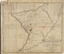
| Date: | 1829 |
|---|---|
| Description: | Cincinnati, Ohio, Ebr. Martin, engraver. |

| Date: | 1853 |
|---|---|
| Description: | Railroad map outlines mid and southern Wisconsin county boundaries in red, and city/town lines are provided. Other marks include lead mines, copper mines, ... |
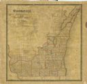
| Date: | 1846 |
|---|---|
| Description: | This map shows the counties and towns in existence at the time as well as lead and copper mines. |

| Date: | 1850 |
|---|---|
| Description: | This detailed map outlines mid and southern WI county boundaries in bright color, and city/town lines are provided. Other marks include lead mines, copper ... |
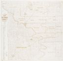
| Date: | 1978 |
|---|---|
| Description: | A map showing allotments of American Indian tribes in Ottawa County, Oklahoma. On the left side is a listing of Lead & Zinc Mines. |

| Date: | 1864 |
|---|---|
| Description: | This map is pen and watercolor on paper and shows profile and geological formation of Blue Mound and location of Arnold’s Hotel and Brigham Lead Mines. |
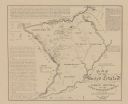
| Date: | 1888 |
|---|---|
| Description: | This is a reproduction of a map originally published in 1829 by R.W. Chandler, a pioneer settler of Galena. It is based on an earlier map by surveyor Luciu... |

| Date: | 1850 |
|---|---|
| Description: | Lithograph of a map drawn to indicate a mine on land owned by Mineral Point Mining Co. in the lead region of southwestern Wisconsin. |

| Date: | 1881 |
|---|---|
| Description: | Darlington's first settlers arrived by 1826, attracted by the lead mines of the area. Arrival of the railroad in 1856 stimulated growth, and in 1857 the co... |
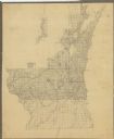
| Date: | 1842 |
|---|---|
| Description: | This map shows portions of northern Illinois and Wisconsin surveyed by the map's creation. It shows county lines and university land, and depicts lead and ... |

| Date: | 1805 |
|---|---|
| Description: | Map of the United States. It shows the states, cities, towns, Native American land, mountains, lakes, and rivers. Tennessee, Kentucky, and Ohio are labeled... |
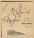
| Date: | 1858 |
|---|---|
| Description: | This 1858 map shows mine shafts, lead veins, and topography on the property of the New Diggings and Shullsburg Mining Company in Section 5 of Township 1 N.... |
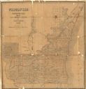
| Date: | 1849 |
|---|---|
| Description: | Published a year after Wisconsin entered statehood, this map shows the counties and towns in existence at the time - mainly in southern/southeastern Wiscon... |
If you didn't find the material you searched for, our Library Reference Staff can help.
Call our reference desk at 608-264-6535 or email us at: