Search the Wisconsin Historical Society's collections

Searching for

Refine by

Results 1-20 of 26

Biographical Book Excerpt

Dexter, Timothy

Date: 1747 - 1806
County: 
Biographical Book Excerpt

Marion, Francis

Date: 1732 - 1795
County: 
Biographical Book Excerpt

Brunson, Alfred

Date: 1793 - 1882
County: 
Biographical Book Excerpt

Spooner, Wyman

Date: 1795 - 1877
County: Walworth
Biographical Book Excerpt

Dunn, Charles

Date: 1799 - 1872
County: 
Biographical Book Excerpt

Irvin, David

Date: 1794 - 1872
County: 
Biographical Book Excerpt

Agry, David

Date: 1794 - 1877
County: 
Biographical Book Excerpt

Lockwood, James, H.

Date: 1793 - 1857
County: 
Biographical Book Excerpt

Blackstone, John, Wilford

Date: 1796 - 1868
County: 
Biographical Book Excerpt

Doty, James, Duane

Date: 1799 - 1865
County: 
Biographical Book Excerpt

Frazer, William, C.

Date: 1776 - 1838
County: 
Biographical Book Excerpt

Hamilton, William, Stephen

Date: 1797 - 1850
County: 
Biographical Book Excerpt

Magoon, Richard, H.

Date: 1799 - 1875
County: 
Biographical Book Excerpt

Smith, William, Rudolph

Date: 1787 - 1868
County: 
Newspaper Article/Clipping

United States Constitution, Front

Date: 09 19 1787
Description: The first printing of the United States Constitution found in the "Pennsylvania Packet," and "Daily Advertiser."
Newspaper Article/Clipping

United States Constitution, Back

Date: 09 19 1787
Description: The first printing of the United States Constitution found in the "Pennsylvania Packet," and "Daily Advertiser."
Map or Atlas

Plan of the City of New York

Date: 1789
Description: Map of New York City showing ward boundaries, ferries, streets, roads, swamps, ponds, and rivers. The properties of Lispinard, Byards, Jones, Rutgers, and ...
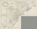
Map or Atlas

Canada, Louisiane et Terres Angloises

Date: 1755
Description: Large format map of America and Canada east of the Mississippi River. D'Anville marks the locations of rivers, lakes, settlements, cities, Native American ...
Map or Atlas

A New General Chart of the Atlantic or Western Ocean and Adjacent Seas

Date: 1786
Description: One half of a four sheet nautical chart, showing the coastlines of the north-west hemisphere. The interior lands are left bare, even of basic features such...
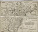
Map or Atlas

A Map of the British and French Settlements in North America

Date: 1755
Description: Map of North America east of the Mississippi River showing cities, settlements, Native American land, mountains, lakes, rivers, and the boundaries between ...

Have Questions?

If you didn't find the material you searched for, our Library Reference Staff can help.

Call our reference desk at 608-264-6535 or email us at: