Search: marker
Filter: Categories of Wisconsin Historical Images
Filter: Subject of monuments
Filter: Subject of signs and symbols
Search: marker
Filter: Categories of Wisconsin Historical Images
Filter: Subject of monuments
Filter: Subject of signs and symbols
| Date: | 1938 |
|---|---|
| Description: | The 45th parallel of north latitude marker, marking halfway between the equator and the north pole. The marker is located on Highway 141, three miles north... |
| Date: | 12 10 1951 |
|---|---|
| Description: | Peshtigo Fire Cemetery marker, shown on the site. |

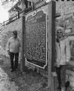
| Date: | 10 05 1951 |
|---|---|
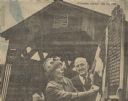
| Description: | Governor Walter J. Kohler Jr., (left) and James R. Law, state highway commission chairman, standing indoors with the Peshtigo cemetery marker. The marker w... |
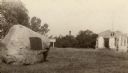
| Date: | 1922 |
|---|---|
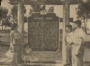
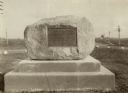
| Description: | The Pecatonica Battlegound marker, erected by the Rhoda Hinsdale Chapter of the Daughters of the American Revolution of Shullsburg and by the town of Wiota... |
| Date: | 1940 |
|---|---|
| Description: | A view of a marker on highway 41 designating the half way point between the Equator and the North Pole. |

| Date: | 10 07 1951 |
|---|---|
| Description: | A group of survivors of the Peshtigo Fire of 1871 are gathered in front of the Peshtigo Fire historical marker. The marker dedication coincided with the 80... |
| Date: | 06 05 1997 |
|---|---|
| Description: | "On this date, the Solomon Juneau House marker is erected. The marker program was started in 1952 and now numbers 347 markers throughout the state, with si... |
| Date: | 05 23 1965 |
|---|---|
| Description: | One of the last covered bridges in Wisconsin, located in Cedarburg, received an official state historical marker. The Last Covered Bridge historical marker... |
| Date: | 06 05 1955 |
|---|---|
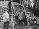
| Description: | Fourth, fifth, and sixth generations of the Knaggs family gathered by the Knaggs Ferry historical marker to honor their family member. Mrs. Walter Dugolens... |
| Date: | 1930 |
|---|---|
| Description: | An Indian trail marker erected "in honor of our pioneers". This trail later became the Plank Road between Sheboygan and Fond du Lac, Wisconsin. The first h... |
| Date: | 1924 |
|---|---|
| Description: | An Indian trail marker erected "in honor of our pioneers". The trail later became the Plank Road between Sheboygan and Fond du Lac, Wisconsin. The first ho... |
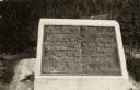
| Date: | |
|---|---|
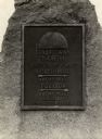
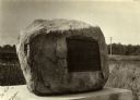
| Description: | Old Lead Road Marker. Marker reads: "The Old Lead Road. In 1828, ox-teams, guided along an ancient Winnebago Indian Trail, began hauling over this road. Ju... |

| Date: | 1969 |
|---|---|
| Description: | Possibly the officers of the Wisconsin Chapter of the Junior National Association of the Deaf sitting in front of the historical marker documenting Wiscons... |
| Date: | 1920 |
|---|---|
| Description: | Historic site marker to commemorate Man Mound and to mark Man Mound Park. The inscription reads "Man Mound Park. Mound located and platted by W.H. Canfield... |

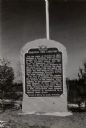
| Date: | |
|---|---|
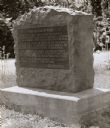
| Description: | Plaque marker identifying the “Pioneer Military Road” route from Fort Howard at Green Bay to Fort Crawford at Prairie du Chien. |
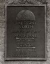
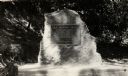
| Date: | 08 1931 |
|---|---|
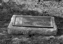
| Description: | The Beaumont memorial marker on the site of Fort Crawford. |
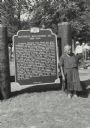
| Date: | 09 02 1957 |
|---|---|
| Description: | Mrs. Nellie Red Cloud, mother of the Korean War hero, Corporal Mitchell Red Cloud, Jr., standing in front of the historical marker dedicated to her son. Sh... |
| Date: | 1927 |
|---|---|
| Description: | Military road marker erected in 1927 by Iowa Daughters of the American Revolution at the foot of the old road opposite Prairie du Chien. The road was built... |
| Date: | 1926 |
|---|---|
| Description: | A marker commemorating the French fort erected by Rene Godefrey, Sieur de Linctot, which existed on this site between 1731-1736. It is thought that the sit... |
If you didn't find the material you searched for, our Library Reference Staff can help.
Call our reference desk at 608-264-6535 or email us at: