 Search: menominee

| Date: | 1920-11-07 |
|---|---|
| County: | Winnebago |
| City: | Oshkosh |
| Community: | Aurora |
|---|---|
| County: | Florence |
| Historic Name: | |
| Reference Number: | 22360 |
| Community: | Marinette |
|---|---|
| County: | Marinette |
| Historic Name: | |
| Reference Number: | 29079 |
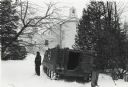
| Date: | 1935 |
|---|---|
| Description: | Two men and a woman are walking from a parked automobile toward the covered porch of the Oshkosh Trading Post, a low, log building on the Menominee Indian ... |
| Date: | 1911-08-04 |
|---|---|
| County: | Winnebago |
| City: | Oshkosh |
| Date: | 1925-02-22 |
|---|---|
| County: | Milwaukee |
| City: | Milwaukee |
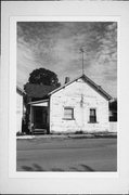
| Community: | Aurora |
|---|---|
| County: | Florence |
| Historic Name: | |
| Reference Number: | 22342 |
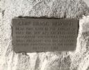
| Date: | 1920 |
|---|---|
| Description: | Close-up of the plaque on the memorial to Camp Bragg, located in Menominee Park. It reads: "Camp Bragg Memorial Near this spot in the autumn of 1862 the 21... |

| Date: | 08 27 1910 |
|---|---|
| Description: | Looking south towards the 16th Street viaduct over Menominee Valley from about Clybourn Street. Shows the surrounding industrial area and neighborhoods. Se... |

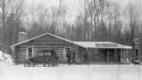
| Date: | |
|---|---|
| Description: | "Peavy Falls Group" of men and boys posed on bank of river. There is a man in a canoe in the river, and a footbridge in the background. |
| Date: | 1975 |
|---|---|
| Description: | Wisconsin National Guard and an armored personnel carrier at the Alexian Brothers Novitiate at Greshman during the Menominee seizure of the building. |

| Date: | 1851 |
|---|---|
| Description: | This manuscript map of the southern portion of the Town of Porterfield, Marinette County, Wisconsin, shows sections and land ownership. The Menominee River... |

| Date: | 1887 |
|---|---|
| Description: | This manuscript map of the southern portion of the Town of Porterfield, Marinette County, Wisconsin, shows sections and land ownership. The Menominee River... |

| Date: | 1891 |
|---|---|
| Description: | Map shows Iron and Dickinson Counties, Mich. and Florence County, Wis. "Nov. 1st, 1891." Irregularly shaped. Includes table of distances and township diagr... |

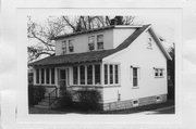
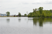
| Community: | Marinette |
|---|---|
| County: | Marinette |
| Historic Name: | MERRYMAN ISLAND LUMBER SETTLEMENT HOUSE |
| Reference Number: | 22765 |
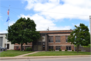
| Community: | Marinette |
|---|---|
| County: | Marinette |
| Historic Name: | Marinette & Menominee Paper Co Park Mill Power Channel Lock |
| Reference Number: | 228006 |
| Community: | Marinette |
|---|---|
| County: | Marinette |
| Historic Name: | Marinette & Menominee Paper Company Park Mills Plant and Dam |
| Reference Number: | 23086 |

| Date: | 2000 |
|---|---|
| Description: | This map shows the industrial area along the Menominee River and canals. Industrial buildings are shown in orange and labeled in red. Other areas are shown... |
If you didn't find the material you searched for, our Library Reference Staff can help.
Call our reference desk at 608-264-6535 or email us at:
