 Search: milwaukee
Filter: Community of Milwaukee
Filter: Type of Map or Atlas
Search: milwaukee
Filter: Community of Milwaukee
Filter: Type of Map or Atlas

| Date: | 1836 |
|---|---|
| Description: | Pencil on tracing paper. Rough sketch of Milwaukee. Left top corner reads: "From Map of northern part of Illinois and the surveyed part of Wisconsin Territ... |

| Date: | 1854 |
|---|---|
| Description: | Reproduction printed on glossy, cloth-backed paper. Right side includes "References," or points of interest that correspond to numbers on the map. Running ... |
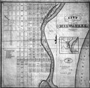
| Date: | 1836 |
|---|---|
| Description: | Map of Milwaukee including the Milwaukee River and Lake Michigan shore. |

| Date: | 1910 |
|---|---|
| Description: | A Sanborn insurance map of Milwaukee, including the shore of Lake Michigan. |

| Date: | 1950 |
|---|---|
| Description: | This map is accompanied by booklet: "Know Milwaukee Map and Street Guide". The map is a detailed map of Milwaukee and the surrounding suburbs. Streets and ... |

| Date: | 1894 |
|---|---|
| Description: | Sanborn Map of the Illinois Steel Co. Bay View Works in Milwaukee. |

| Date: | 1968 |
|---|---|
| Description: | A tourist map of Milwaukee County and of downtown Milwaukee. The Map of Milwaukee County identifies the location of some of the points of interests in the ... |

| Date: | 1881 |
|---|---|
| Description: | Bird's-eye view of Milwaukee from the south lakeshore. |

| Date: | 1910 |
|---|---|
| Description: | Sanborn insurance map of Milwaukee showing a portion of Jones Island with Lake Michigan at the top and the Milwaukee River at the bottom. |

| Date: | 1894 |
|---|---|
| Description: | Sanborn map of Milwaukee, with the Milwaukee River on the left, and Water Street in the center. There are two iron draw bridges over the river. |

| Date: | 1872 |
|---|---|
| Description: | Bird's-eye map of Milwaukee on Lake Michigan. |

| Date: | 1896 |
|---|---|
| Description: | Map highlighting parks and other points of interest in Milwaukee. |
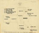
| Date: | 12 23 1949 |
|---|---|
| Description: | Typed and printed ink on paper. Map lists and shows suburbs in 1940. Map reads: "Milwaukee Metropolitan district in 1940. Pub. in Bayrd Still’s Milwaukee, ... |

| Date: | 1880 |
|---|---|
| Description: | A map of Milwaukee which includes a city street guide. |

| Date: | 1894 |
|---|---|
| Description: | Sanborn map of a portion of Milwaukee, including St. Clair and Bishop and Potter Avenues. There is an inset for the South Side Wood Working Co. |

| Date: | 04 04 1934 |
|---|---|
| Description: | Street map of the city of Milwaukee and surrounding communities at a scale of 1 inch to 1200 feet. |

| Date: | 1910 |
|---|---|
| Description: | A Sanborn insurance map of a section of Milwaukee, including East Clybourn and East Buffalo Streets. "Italian Section 3/4/30" is written on the page in blu... |
If you didn't find the material you searched for, our Library Reference Staff can help.
Call our reference desk at 608-264-6535 or email us at:


