Visit our other Wisconsin Historical Society websites!
 Search: milwaukee
Filter: Subject of transportation
Search: milwaukee
Filter: Subject of transportation

| Date: | 1854 |
|---|---|
| Description: | Reproduction printed on glossy, cloth-backed paper. Right side includes "References," or points of interest that correspond to numbers on the map. Running ... |
| Date: | 1906 |
|---|---|
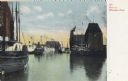
| Description: | Boats on the Milwaukee River. Caption reads: "Boats on Milwaukee River." |
| Date: | 1905 |
|---|---|
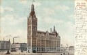
| Description: | Slightly elevated view of Milwaukee City Hall. Caption reads: "City Hall, Milwaukee, Wis." |

| Date: | 1928 |
|---|---|
| Description: | Exterior view of the Milwaukee Post Office. |

| Date: | 1873 |
|---|---|
| Description: | Newspaper reproduction of an etching of the Milwaukee River. |

| Date: | 1964 |
|---|---|
| Description: | Aerial view of the Milwaukee County Zoo grounds nearing its completion. |

| Date: | 1982 |
|---|---|
| Description: | Typical room at the Milwaukee River Hilton Inn in MIlwaukee. |
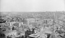
| Date: | |
|---|---|
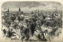
| Description: | Milwaukee, view northeast from Exposition Building. |
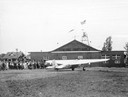
| Date: | 1928 |
|---|---|
| Description: | A Hamilton Metalplane, which was manufactured by the Hamilton Aero Manufacturing Co. of Milwaukee, at the Milwaukee County Airport. |
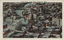
| Date: | 1925 |
|---|---|
| Description: | Downtown aerial view with the Milwaukee River and City Hall. Caption reads: "Downtown Aerial View, Milwaukee, Wis." |
| Date: | 1940 |
|---|---|
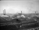
| Description: | Elevated view of the Milwaukee rail yards. |

| Date: | 1947 |
|---|---|
| Description: | City Hall near the Milwaukee River. |
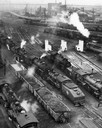
| Date: | |
|---|---|
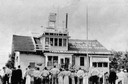
| Description: | Elevated view of the West Milwaukee shops of the Chicago, Milwaukee & St. Paul Railroad. |

| Date: | 1915 |
|---|---|
| Description: | Elevated view of the Wells Street Viaduct. Caption reads: "Wells Street Viaduct, Milwaukee." |

| Date: | 1910 |
|---|---|
| Description: | A Sanborn insurance map of Milwaukee, including the shore of Lake Michigan. |

| Date: | 1906 |
|---|---|
| Description: | Bird's-eye map of South Milwaukee. |
If you didn't find the material you searched for, our Library Reference Staff can help.
Call our reference desk at 608-264-6535 or email us at: