Search: milwaukee
Filter: Year of 1800-1899
Search: milwaukee
Filter: Year of 1800-1899
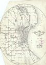
| Date: | 06 1858 |
|---|---|
| Description: | This map shows additions and subdivisions to Milwaukee, city wards, roads, railroads, and selected buildings. This map was engraved to accompany the city d... |

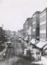
| Date: | 1870 |
|---|---|
| Description: | Stereograph; looking down a wide, tree-lined dirt road. A fence is visible behind the tree line on the right. |
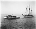
| Date: | 1898 |
|---|---|
| Description: | View across water of a tugboat pulling a sailboat towards Milwaukee on Lake Michigan. |
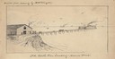
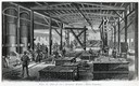
| Date: | 1850 |
|---|---|
| Description: | An illustration of the Old North Pier landing on Huron Street, drawn from memory. |

| Community: | Milwaukee |
|---|---|
| County: | Milwaukee |
| Historic Name: | |
| Reference Number: | 103164 |
| Community: | Milwaukee |
|---|---|
| County: | Milwaukee |
| Historic Name: | |
| Reference Number: | 106876 |

| Community: | Milwaukee |
|---|---|
| County: | Milwaukee |
| Historic Name: | |
| Reference Number: | 109558 |
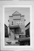
| Community: | Milwaukee |
|---|---|
| County: | Milwaukee |
| Historic Name: | |
| Reference Number: | 109749 |

| Nearby City: | Milwaukee, Milwaukee County |
|---|---|
| Body of water: | Lake Michigan |
| Community: | Milwaukee |
|---|---|
| County: | Milwaukee |
| Historic Name: | |
| Reference Number: | 115121 |
| Ship Master: | James Doyle |
|---|---|
| Nearby City: | Milwaukee, Milwaukee County |
| Body of water: | Lake Michigan |
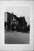
| Community: | Milwaukee |
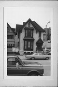
|---|---|
| County: | Milwaukee |
| Historic Name: | William Thwait House |
| Reference Number: | 111363 |

| Date: | 1846 |
|---|---|
| Description: | This map shows lot and block numbers, local streets, railroads, some landowners’ names, Milwaukee River, Menomonee River, and part of Lake Michigan. The ma... |

| Date: | 1847 |
|---|---|
| Description: | This map shows lot and block numbers, roads, railroads, and some landowners’ names. Lake Michigan, the Milwaukee River, and the Menomonee River are labeled... |

| Date: | 1854 |
|---|---|
| Description: | This map shows lot and block numbers, roads, railroads, and some landowners’ names. Lake Michigan, the Milwaukee River, and the Menomonee River are labeled... |

| Date: | 1849 |
|---|---|
| Description: | This map shows lot and block numbers, wards, local streets, railroads, some landowners’ names, Milwaukee River, Menomonee River, and part of Lake Michigan.... |

| Date: | 1849 |
|---|---|
| Description: | This map shows lot and block numbers, wards, local streets, railroads, some landowners’ names, Milwaukee River, Menomonee River, and part of Lake Michigan.... |
If you didn't find the material you searched for, our Library Reference Staff can help.
Call our reference desk at 608-264-6535 or email us at: