Search: mines
Search: mining
Filter: Categories of Wisconsin Historical Images
Filter: Subject of lead mines and mining
Search: mines
Search: mining
Filter: Categories of Wisconsin Historical Images
Filter: Subject of lead mines and mining

| Date: | 1829 |
|---|---|
| Description: | Map of lead mines operating in Wisconsin. |

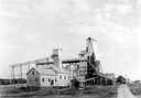
| Date: | 1936 |
|---|---|
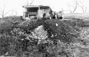
| Description: | View from road of lead and zinc mines and surrounding buildings. |
| Date: | 1850 |
|---|---|
| Description: | Blast furnace, also known as a Scotch hearth used in lead mining. |

| Date: | 1829 |
|---|---|
| Description: | Cincinnati, Ohio, Ebr. Martin, engraver. |
| Date: | 1853 |
|---|---|
| Description: | Engraved exterior view of a lead mining furnace. A man sits in a horse-drawn wagon at the left of the building. |

| Date: | 1800 |
|---|---|
| Description: | Map of the United States. It shows the states, including Tennessee, cities, towns, Native American land, mountains, lakes, and rivers. Lead mines appear ju... |

| Date: | 1850 |
|---|---|
| Description: | Lithograph of a map drawn to indicate a mine on land owned by Mineral Point Mining Co. in the lead region of southwestern Wisconsin. |
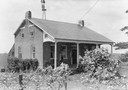
| Date: | |
|---|---|
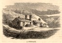
| Description: | Uppena home, built by Bernard Henry Uppena in 1850. |
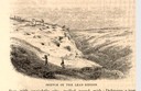
| Date: | 1853 |
|---|---|
| Description: | Engraved view of miners and hillside mines in the Lead Region. Caption reads: "Sketch of the Lead Region." |
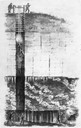
| Date: | 1844 |
|---|---|
| Description: | Cross section drawing of a Wisconsin lead mine. |

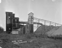
| Date: | 1939 |
|---|---|
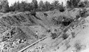
| Description: | International PA-100 power unit operating a Pomona water pump in a lead and zinc mine. A box labeled "dynamite" is in the foreground. |

| Date: | 1829 |
|---|---|
| Description: | Photoprint of Crawford County lead district map. |
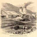
| Date: | 05 1866 |
|---|---|
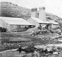
| Description: | Engraved exterior view of a smelting furnace with a small group of men with horses gathered in front. |
If you didn't find the material you searched for, our Library Reference Staff can help.
Call our reference desk at 608-264-6535 or email us at: