| Date: | |
|---|---|
| Description: | Photographic postcard of an old Indian trail marker, a twisted tree, as seen on top of Blue Mounds. Text below reads: "'Old Indian Trail Marker' Top of Blu... |

| Date: | 05 05 1939 |
|---|---|
| Description: | Charles E. Brown poses near a historic tablet marking one of a row of conical burial mounds on the Park and Pleasure drive on the north shore of Lake Wingr... |

| Date: | 1925 |
|---|---|
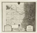
| Description: | This map shows trails, mounds, villages, corn fields, and contemporary civil townships; some villages and features include both Indian and English place na... |

| Date: | 04 28 2015 |
|---|---|
| Description: | View down a gravel path leading into a forest. The trees are bare of leaves, but the grass is green. A wood marker is at the intersection of a dirt path on... |

| Date: | 1974 |
|---|---|
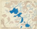
| Description: | This 1974 map is a reproduction of the original survey maps of the Four Lakes region of Dane County, Wisconsin. It shows sections, lakes, rivers, wetlands,... |

| Date: | 1970 |
|---|---|
| Description: | This pictorial map of Dunn County, Wisconsin, from the 1970s depicts historical events that occurred in the county. It shows cemeteries, churches, schools,... |
If you didn't find the material you searched for, our Library Reference Staff can help.
Call our reference desk at 608-264-6535 or email us at: