 Search: mounds
Filter: Year of 1900-1999
Filter: Type of Map or Atlas
Search: mounds
Filter: Year of 1900-1999
Filter: Type of Map or Atlas

| Date: | 1916 |
|---|---|
| Description: | In 1916, it was estimated that 15,000 Indian mounds had formerly existed in Wisconsin. In the early 20th century, the Wisconsin Archaeological Society surv... |

| Date: | 1941 |
|---|---|
| Description: | This pictorial map shows sites related to Indian legends, mounds, and trails in the Chain O' Lakes region in southwestern Waupaca County, Wisconsin. |

| Date: | 1903 |
|---|---|
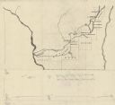
| Description: | This maps shows what may be Ho Chunk Native American burial mounds. Also noted on the map is the Fox River, the Doty homestead, stockade embankment, the We... |

| Date: | 10 1911 |
|---|---|
| Description: | This map shows lot numbers, building lines, roads, trees, and Indian mounds. Relief is shown by contours. Includes manuscript annotations marking parks. |

| Date: | 1931 |
|---|---|
| Description: | This map of south central Wisconsin shows lakes, rivers, cities, villages, highways and roads, railroads, Indian mounds, and points of scenic and historic ... |

| Date: | 1900 |
|---|---|
| Description: | This photocopy map shows marshes, woods, buildings, and selected features including islands, mounds, old Fort Crawford, and "new site for a fort in questio... |

| Date: | 1925 |
|---|---|
| Description: | This map shows trails, mounds, villages, corn fields, and contemporary civil townships; some villages and features include both Indian and English place na... |

| Date: | 1919 |
|---|---|
| Description: | Narrow red lines show principal secondary highways. Green circles shows points of historical interest. Green triangles show Indian mounds and Indian villag... |

| Date: | 1974 |
|---|---|
| Description: | This 1974 map is a reproduction of the original survey maps of the Four Lakes region of Dane County, Wisconsin. It shows sections, lakes, rivers, wetlands,... |

| Date: | 1927 |
|---|---|
| Description: | Blueprint-style map of Frost Woods on the shore of Lake Monona. The map indicates the locations of Indian mounds, an Indian camp, and various plants. There... |
| Date: | 1935 |
|---|---|
| Description: | This manuscript map shows route of the early military road in Wisconsin from Green Bay (Fort Howard) through Portage (Fort Winnebago) to Fort Blue Mounds a... |

| Date: | 1924 |
|---|---|
| Description: | A map of the Madison Township, T7N R9E including Lake Mendota showing the location of Ho Chunk encampments and effigy mounds. |
| Date: | 1909 |
|---|---|
| Description: | This map shows the Chicago and North Western Railway lines in eastern Wisconsin, north to Wausau and Oconto and west to Baraboo and Blue Mounds, and northe... |

| Date: | 1920 |
|---|---|
| Description: | A map of the Nelson-Dewey State Park at the confluence of the Mississippi and Wisconsin rivers, showing the topographical features of the area, as well as ... |

| Date: | 1969 |
|---|---|
| Description: | A map of Wisconsin from The Atlas of the Eight Counties of Forest, Florence, Iron, Langlade, Lincoln, Oneida, Price, Vilas. The map shows rivers and a vari... |

| Date: | 1970 |
|---|---|
| Description: | This pictorial map of Dunn County, Wisconsin, from the 1970s depicts historical events that occurred in the county. It shows cemeteries, churches, schools,... |

| Date: | 1915 |
|---|---|
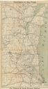
| Description: | This 1915 map covers portions of Barron, Chippewa, and Rusk counties in Wisconsin. Shown are the township and range grid, sections, cities and villages, ra... |
| Date: | 1975 |
|---|---|
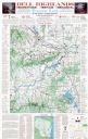
| Description: | This map shows points of interest in south central Wisconsin from the Wisconsin Dells and the Baraboo Hills down to Madison and Blue Mounds. Interest point... |

| Date: | 1920 |
|---|---|
| Description: | This 1920 map actually depicts present-day Wyalusing State Park at the confluence of the Mississippi and Wisconsin rivers in the Town of Wyalusing, Grant C... |

| Date: | 1924 |
|---|---|
| Description: | This pictorial map focuses on the Madison Isthmus, Lake Mendota, Lake Monona, Lake Wingra, and shows points of historical interest, buildings, parks, and I... |
If you didn't find the material you searched for, our Library Reference Staff can help.
Call our reference desk at 608-264-6535 or email us at: