Search: mounds
Filter: Year of 1900-1999
Filter: Year of 1930-1939
Search: mounds
Filter: Year of 1900-1999
Filter: Year of 1930-1939
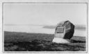
| Date: | 1930 |
|---|---|
| Description: | View of an Indian mounds marker on the St. Croix River. |

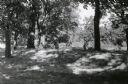
| Date: | 05 05 1939 |
|---|---|
| Description: | Charles E. Brown poses near a historic tablet marking one of a row of conical burial mounds on the Park and Pleasure drive on the north shore of Lake Wingr... |
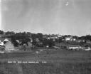
| Date: | 1930 |
|---|---|
| Description: | Bird's-eye view town. There are barns, homes, a church's steeple and a lumberyard. |
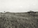
| Date: | 1935 |
|---|---|
| Description: | View of the site when it was known as Aztalan Mound Park or Aztalan Mounds, near Lake Mills. There is a pavilion in the right background. |

| Date: | 1930 |
|---|---|
| Description: | Remains of the racetrack on the top of Blue Mound. |
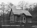
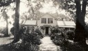
| Date: | 1930 |
|---|---|
| Description: | Exterior of a cabin in Nissedahle (Little Norway). |
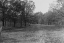
| Date: | 1930 |
|---|---|
| Description: | View of a wide path through trees in the spring or summer. |

| Date: | 1930 |
|---|---|
| Description: | Aerial view of the town, including the central business district. |

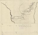
| Date: | 1931 |
|---|---|
| Description: | This map of south central Wisconsin shows lakes, rivers, cities, villages, highways and roads, railroads, Indian mounds, and points of scenic and historic ... |
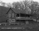
| Date: | 1930 |
|---|---|
| Description: | Exterior of a two-story cabin in Nissedahle (Little Norway). There is a cafe on the first floor. |
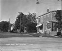
| Date: | 1930 |
|---|---|
| Description: | A man and his two children pose at the corner near the post office. |
| Date: | 1935 |
|---|---|
| Description: | This manuscript map shows route of the early military road in Wisconsin from Green Bay (Fort Howard) through Portage (Fort Winnebago) to Fort Blue Mounds a... |
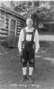
| Date: | 1935 |
|---|---|
| Description: | A man identified only as "Sticky" is posing standing on the lawn in front of a log cabin at Little Norway. He is wearing traditional Norwegian dress with e... |

| Date: | 1933 |
|---|---|
| Description: | Blue print and blue line print maps that show local streets, Nakoma Country Club, part of Lake Forest, and part of Lake Wingra. A legend is included that s... |
| Date: | 06 1939 |
|---|---|
| Description: | Elevated view of the tourist attraction Little Norway, situated in an idyllic valley, with the stave church in the center and a small house at right. There... |

| Date: | 06 30 1939 |
|---|---|
| Description: | A drawing of a lizard-shaped Indian mound at Hudson Park. |

| Date: | 1930 |
|---|---|
| Description: | Poppies are blooming in a large field with a hill in the background. The photographer identifies the hill as a shell mound. The shell mound is likely the l... |
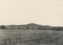
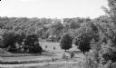
| Date: | 07 1933 |
|---|---|
| Description: | Front view of Man Mound House, with trees and a walkway which leads to the front door. The walkway appears to be on a mound. |
| Date: | 1939 |
|---|---|
| Description: | Burl Briggs (right), and an unknown companion pose behind a linear burial mound on the University of Wisconsin-Madison campus. |
If you didn't find the material you searched for, our Library Reference Staff can help.
Call our reference desk at 608-264-6535 or email us at: