| Date: | 1881 |
|---|---|
| Description: | Bird's-eye map of Marinette, with insets. |

| Date: | 1925 |
|---|---|
| Description: | Shows buildings, piers, winter and summer levels, and resort lands. Depths shown by isolines. Relief shown by contours. From the E.P. Sherry papers relatin... |

| Date: | 1884 |
|---|---|
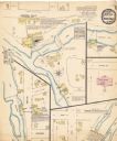
| Description: | Page one of a Sanborn map of River Falls, Wisconsin. |

| Date: | 1864 |
|---|---|
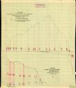
| Description: | This map is pen and watercolor on paper and shows profile and geological formation of Blue Mound and location of Arnold’s Hotel and Brigham Lead Mines. |

| Date: | 1903 |
|---|---|
| Description: | This map is ink on printed paper reading: "standard profile plate." "Surveyed Oct. 15, platted Dec. 15, 1903 ; surveyed May 9, platted Dec. 9." |

| Date: | 07 1870 |
|---|---|
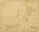
| Description: | This map of Ironton is pen-and-ink on paper and shows lots and block numbers, mill, foundry buildings, limestone quarry, iron mine, and roads. Relief is sh... |

| Date: | 1900 |
|---|---|
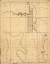
| Description: | This map shows a paper city located on Swan Lake in Columbia County. It includes lot and block numbers, two public squares, and two little lakes of "good w... |

| Date: | 1855 |
|---|---|
| Description: | This map is ink, pen, and watercolor on paper and shows plat of the town, local streets, lots by number, U.S. subdivisions in red lines, Mineral Point Rail... |

| Date: | 1917 |
|---|---|
| Description: | Shows landownership, buildings, and swamps around Rest Lake in Vilas County, Wisconsin. Relief shown by contours. "May 1917." From the E.P. Sherry papers r... |

| Date: | 1947 |
|---|---|
| Description: | An ink on paper, hand-drawn map of Jefferson County, Wisconsin, that identifies named hills, other points of interest, and the Lake Mills moraine system in... |

| Date: | 1903 |
|---|---|
| Description: | This blue line print map is oriented with the north to the left and shows buildings with dimensions, utilities, and proposed buildings. The Flambeau River ... |

| Date: | 1883 |
|---|---|
| Description: | Bird's-eye map of Superior, county seat of Douglas County, on the shores of Lake Superior, with insets of points of interest. |

| Date: | 1930 |
|---|---|
| Description: | Pen and ink map on paper of Wisconsin and northern Illinois showing stagecoach routes (marked in red) that traveled between Lake Michigan and the Mississip... |

| Date: | 1855 |
|---|---|
| Description: | This map is ink, pencil, and color on paper and shows property owners, a cemetery, farms, hotels, roads, a dike and on the back are additional notes. Notes... |

| Date: | 1835 |
|---|---|
| Description: | Ink on tracing paper map of Green Bay, Wisconsin and nearby areas, Lake Winnebago, Fox and Wolf Rivers, and the junctions of the Mississippi and Wisconsin ... |

| Date: | 1856 |
|---|---|
| Description: | This map is ink and watercolor on tracing paper and shows plat of city, local streets, block numbers, topography, several buildings, and includes an explan... |

| Date: | 11 1923 |
|---|---|
| Description: | This map shows buildings, lots, utilities, and original plat and present locations of railroads. Portions of the map are shown in red, brown, yellow, blue,... |
If you didn't find the material you searched for, our Library Reference Staff can help.
Call our reference desk at 608-264-6535 or email us at: