
| Date: | 1881 |
|---|---|
| Description: | Bird's-eye map of Marinette, with insets. |
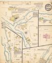
| Date: | 1884 |
|---|---|
| Description: | Page one of a Sanborn map of River Falls, Wisconsin. |

| Date: | 1836 |
|---|---|
| Description: | This map is pen-and-ink on paper and shows marshlands, rivers, creeks, a quarry, and a few roads. |

| Date: | 1900 |
|---|---|
| Description: | Shows limits of drainage basin, dams, rapids, roads, and railroads in parts of Iron and Vilas Counties, Wisconsin. From the E.P. Sherry papers relating to ... |

| Date: | 1855 |
|---|---|
| Description: | This map is ink, pen, and watercolor on paper and shows plat of the town, local streets, lots by number, U.S. subdivisions in red lines, Mineral Point Rail... |

| Date: | 1800 |
|---|---|
| Description: | This map of the Little Kaukalin Region is ink on paper and shows Little Kaukalin Rapids, Black Bird Island, buildings, trails, meadows and woods, and a sug... |

| Date: | 1903 |
|---|---|
| Description: | This blue line print map is oriented with the north to the left and shows buildings with dimensions, utilities, and proposed buildings. The Flambeau River ... |

| Date: | 1883 |
|---|---|
| Description: | Bird's-eye map of Superior, county seat of Douglas County, on the shores of Lake Superior, with insets of points of interest. |
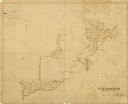
| Date: | 1835 |
|---|---|
| Description: | Ink on tracing paper map of Green Bay, Wisconsin and nearby areas, Lake Winnebago, Fox and Wolf Rivers, and the junctions of the Mississippi and Wisconsin ... |

| Date: | 11 1923 |
|---|---|
| Description: | This map shows buildings, lots, utilities, and original plat and present locations of railroads. Portions of the map are shown in red, brown, yellow, blue,... |
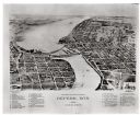
| Date: | 1893 |
|---|---|
| Description: | Bird’s-eye view of Depere looking North. Includes illustrations and an index to points of interest. |

| Date: | 1874 |
|---|---|
| Description: | Bird's-eye view map of Appleton, Wisconsin. Map reads: "NOTE.-Since the above cut was engraved, the Fox River Pulp & Paper Co.'s Mammoth Mills have been er... |

| Date: | 1867 |
|---|---|
| Description: | Birds-eye drawing of Appleton, Outagamie Co., depicting street names and street layout, houses, the Fox River, the court house, jail, school houses, Lawren... |

| Date: | 03 29 1888 |
|---|---|
| Description: | "Dated this 29th day of March AD 1888." Certifications on verso signed by: William Powrie, county surveyor -- Henry Sherry, landowner -- E.E. Paddock, not... |
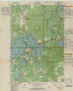
| Date: | 1982 |
|---|---|
| Description: | This standard U.S.G.S. topographic map was annotated by civil engineer and railroad historian James P. Kaysen to show the location of existing and defunct ... |
| Date: | 1909 |
|---|---|
| Description: | This map covers Iron and Price Counties and portions of Sawyer and Oneida Counties. The map shows vacant and sold Wis. Central Ry. land, settlers houses, s... |
If you didn't find the material you searched for, our Library Reference Staff can help.
Call our reference desk at 608-264-6535 or email us at: