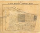
| Date: | 1880 |
|---|---|
| Description: | This map is pen-and-ink on paper. The map shows buildings, trees, and water and gas pipes, relief is shown by contours. The back of the map reads: "Univers... |

| Date: | 1883 |
|---|---|
| Description: | Bird's-eye map of Superior, county seat of Douglas County, on the shores of Lake Superior, with insets of points of interest. |

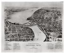
| Date: | 1893 |
|---|---|
| Description: | Bird’s-eye view of Depere looking North. Includes illustrations and an index to points of interest. |

| Date: | 1874 |
|---|---|
| Description: | Bird's-eye view map of Appleton, Wisconsin. Map reads: "NOTE.-Since the above cut was engraved, the Fox River Pulp & Paper Co.'s Mammoth Mills have been er... |

| Date: | 1867 |
|---|---|
| Description: | Birds-eye drawing of Appleton, Outagamie Co., depicting street names and street layout, houses, the Fox River, the court house, jail, school houses, Lawren... |
If you didn't find the material you searched for, our Library Reference Staff can help.
Call our reference desk at 608-264-6535 or email us at: