 Search: paper
Filter: Type of Map or Atlas
Search: paper
Filter: Type of Map or Atlas
| Date: | 1800 |
|---|---|
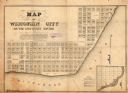
| Description: | Ink and pencil on paper. A paper city on the site of what is now Appleton, Wisconsin. Shows plat of city, streets, and Fox River. Includes textual descript... |
| Date: | 1830 |
|---|---|
| Description: | This plat map is pen-and-ink on tracing paper and shows a paper city planned in the late 1830's located on the shore of Swan Lake, Columbia County, Wiscons... |

| Date: | 1836 |
|---|---|
| Description: | This map is ink and watercolor on paper and shows a plat of a paper city (a city planned but never built). Some streets and the Pekatolica River are labele... |

| Date: | 11 1836 |
|---|---|
| Description: | This map is pen-and-ink on paper and is a plat of a paper city on the Wisconsin River, in what is now the Town of Dekorra. The map shows lot and block numb... |

| Date: | |
|---|---|
| Description: | Hand-drawn, folded extension of map, rendered on notebook paper. |

| Date: | 1836 |
|---|---|
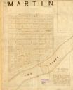
| Description: | This is a cadastral map and shows proposed lot and block numbers for a paper city on the banks of the Rock River. Also shown are two public squares and som... |

| Date: | 1900 |
|---|---|
| Description: | This map shows a paper city located on Swan Lake in Columbia County. It includes lot and block numbers, two public squares, and two little lakes of "good w... |
| Date: | 1900 |
|---|---|
| Description: | Plat map showing a paper city located on the Wisconsin River. The map includes a public square, street names, and a note written by Francis Headman. |
| Date: | 1930 |
|---|---|
| Description: | This map is pen and pencil on paper and shows local streets, lots by number, and section divisions. |

| Date: | 1840 |
|---|---|
| Description: | This map is pencil on paper and shows rivers, granite locations, and selected landmarks. Relief is shown by hachures. |

| Date: | 1835 |
|---|---|
| Description: | This map is pen-and-ink on paper. The map shows landowners in "Milwalky" or present day Milwaukee. Includes "list of property offered to Mr. Walker". The m... |

| Date: | 1900 |
|---|---|
| Description: | Pen and pencil on tracing paper. Shows landownership by name, local streets, local businesses, mill pond, creek, and proposed railroad. |
| Date: | 1836 |
|---|---|
| Description: | This map shows proposed lot and block numbers for a paper city located in township 10 north, range 7 east, Wisconsin Territory, now the Town of West Point,... |

| Date: | 1836 |
|---|---|
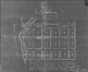
| Description: | This map is ink on tracing paper and shows block numbers, streets, lot numbers of block no. 6, and a public square in Newburgh, a paper city (a city planne... |
| Date: | 1858 |
|---|---|
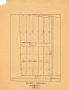
| Description: | Map is ink and pencil on paper. Map showing Leonard's Addition to Salem Wisconsin in Kenosha County. The plats are numbered. |

| Date: | 1800 |
|---|---|
| Description: | This map of North La Crosse is ink and pencil on paper and shows lot ownership and buildings. |

| Date: | 1850 |
|---|---|
| Description: | [... through northern United States from New York to Minnesota]. Lithography by T. Sinclair. From Perrault papers, Lucien S. Hanks, donor. |

| Date: | 1836 |
|---|---|
| Description: | This map is pen-and-ink on paper and shows marshlands, rivers, creeks, a quarry, and a few roads. |

| Date: | 1906 |
|---|---|
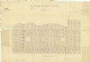
| Description: | This map is pen-and-ink on paper. The relief is shown by contours and spot heights. "5’ contours." Includes area table. |

| Date: | 1840 |
|---|---|
| Description: | Map shows three Wisconsin territories, Jefferson, Waukesha, and Milwaukee. Map is ink, pencil, and watercolor on paper. Relief shown by hachures. |
If you didn't find the material you searched for, our Library Reference Staff can help.
Call our reference desk at 608-264-6535 or email us at: