Search: paper
Filter: County of Grant
Search: paper
Filter: County of Grant

| Date: | 1972 |
|---|---|
| Description: | Ink on tracing paper. This map shows rivers, Prairie du Chien, site of Fort Crawford, Excelsior, Fort Andrew, Boscobel, Blue River, Orion, Muscoda, Castle ... |

| Date: | 1848 |
|---|---|
| Description: | Pen-and-ink on paper. Includes certifications signed by "Geo R. Bluntz, District Survey of Grant Co. W.T." and Ben C. Eastman. |

| Date: | 1942 |
|---|---|
| Description: | This map shows a paper city laid out in 1836 on the Wisconsin River, now the site of Wyalusing State Park, Grant County. The upper right corner includes a ... |
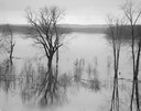
| Date: | 04 18 1965 |
|---|---|
| Description: | Wisconsin River in flood, looking downstream. |
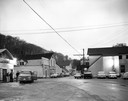
| Date: | 05 07 1962 |
|---|---|
| Description: | Crossroads corner at dusk, following hail storm. |
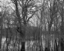
| Date: | 04 18 1965 |
|---|---|
| Description: | View of a wooded area affected by a Wisconsin River flood. |
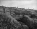
| Date: | 05 16 1962 |
|---|---|
| Description: | Two metal fences with wooden posts in a pasture on a hill. |
| Date: | 08 20 1961 |
|---|---|
| Description: | View of the ground cover and surrounding trees of the Wisconsin River bottom land swamp area. |
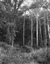
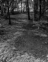
| Date: | 07 03 1965 |
|---|---|
| Description: | View uphill of several birch trees growing at the edge of a forest. |

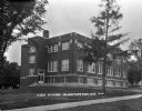
| Date: | |
|---|---|
| Description: | The two-story stone schoolhouse. A flagpole hangs over the entrance. |
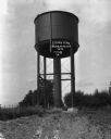
| Date: | 1916 |
|---|---|
| Description: | A water tower with a ruler indicating the amount of the water inside. |
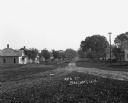
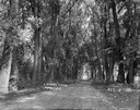
| Date: | |
|---|---|
| Description: | View down an unpaved residential road. Houses are in the background. |
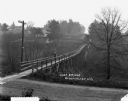
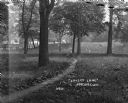
| Date: | |
|---|---|
| Description: | A woman stands on a wooden footbridge. There are homes in the distance. |
If you didn't find the material you searched for, our Library Reference Staff can help.
Call our reference desk at 608-264-6535 or email us at: