 Search: public
Filter: Type of Map or Atlas
Filter: County of Rock
Search: public
Filter: Type of Map or Atlas
Filter: County of Rock

| Date: | 1900 |
|---|---|
| Description: | This map is indexed and shows numbering system, public buildings and parks, wards, and voting booths. |

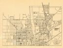
| Date: | 1900 |
|---|---|
| Description: | This map includes an index of streets and schools, and shows parks and public lands, as well as industrial sites. |

| Date: | 1973 |
|---|---|
| Description: | This map includes an index of streets and schools and also shows parks, schools and public lands, and industrial sites. Portions of the map are in green an... |

| Date: | 1890 |
|---|---|
| Description: | Bird's-eye map of Beloit with insets of Williams Engine Works, Eclipse Wind Engine Co., and John Foster & Co. Turtle Creek is in the lower section, and the... |

| Date: | 1836 |
|---|---|
| Description: | This map is ink on tracing paper and shows block numbers, streets, lot numbers of block no. 6, and a public square in Newburgh, a paper city (a city planne... |
| Date: | 1953 |
|---|---|
| Description: | This map of Beloit shows existing platted streets or highways and proposed street right of way. The map reads: "I hereby certify that this is the official ... |
If you didn't find the material you searched for, our Library Reference Staff can help.
Call our reference desk at 608-264-6535 or email us at: