 Search: public
Filter: Subject of streams
Search: public
Filter: Subject of streams
| Date: | 12 01 1935 |
|---|---|
| Description: | This Wisconsin Public Service Commission map shows the lakes and streams of Wisconsin. |

| Date: | 1959 |
|---|---|
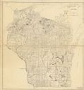
| Description: | This map identifies public forest land and industrial forest land as of 1959 in Oneida County, Wisconsin, using a 1930 base map showing the township and ra... |

| Date: | 1986 |
|---|---|
| Description: | This late 1980s map of Price County, Wisconsin, shows facilities and lands open for public recreation, hunter walking trails and ski trails, campgrounds, b... |

| Date: | 1871 |
|---|---|
| Description: | Birds eye map of Brodhead, WI depicts street names and street locations, houses, and trees. A reference key at the bottom of the map shows the locations of... |

| Date: | 1955 |
|---|---|
| Description: | This map shows roads, golf courses, airports, fire towers, schools, camp grounds, rivers, streams, lakes, and railroads. The right margin of the map includ... |

| Date: | 1950 |
|---|---|
| Description: | View towards a man driving an TD-18A in water. Subject: "TD-18A — Road Maintenance." Where Taken: "SE." Information with photograph reads: "TD-18A owned by... |

| Date: | 1919 |
|---|---|
| Description: | "Map no. 2, Keith and Hiles Lumber Co., Crandon, Wisconsin, Block Map, Block One... Made December 20, 1919. Maker of original map, B. McGinley. Maker of ta... |
If you didn't find the material you searched for, our Library Reference Staff can help.
Call our reference desk at 608-264-6535 or email us at: