 Filter: Categories of Wisconsin Historical Images
Filter: Creator Name of Cram, Thomas Jefferson
Filter: Subject of human settlements
Filter: Year of 1800-1899
Filter: Categories of Wisconsin Historical Images
Filter: Creator Name of Cram, Thomas Jefferson
Filter: Subject of human settlements
Filter: Year of 1800-1899

| Date: | 1839 |
|---|---|
| Description: | This map shows the hydrology of Madison and its vicinity at the height of interest in a proposed Milwaukee and Rock River Canal. It was made by Thomas Jeff... |
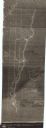
| Date: | 1840 |
|---|---|
| Description: | This map shows shows three routes; a route surveyed by Doty & Center, a route surveyed by inhabitants of East Milwaukee, and a route surveyed by inhabitant... |
If you didn't find the material you searched for, our Library Reference Staff can help.
Call our reference desk at 608-264-6535 or email us at: