| Date: | 1673 |
|---|---|
| Description: | P. Marquette en Joliet, gedan in't jaar 1673. |

| Date: | 1625 |
|---|---|
| Description: | An illustrated map of the world with captions in Latin. Illustrations include depictions of the seasons and the elements. |

| Date: | 1698 |
|---|---|
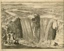
| Description: | An illustration of two men looking out at Niagara Falls. The Niagara Falls in Jean Louis Hennepin’s A new discovery of a vast country in America (London: M... |

| Date: | 1683 |
|---|---|
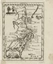
| Description: | Map of the north east coast of North America showing islands, regions, Native American land, bays, and a few European settlements. The Great Lakes appear i... |
If you didn't find the material you searched for, our Library Reference Staff can help.
Call our reference desk at 608-264-6535 or email us at: