| Date: | |
|---|---|
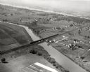
| Description: | Aerial view of a train crossing the East River in a rural community south of Green Bay. Some buildings are visible to the right and the background of the i... |

| Date: | |
|---|---|
| Description: | Memohead of the Henry Rahr Sons' Company of Green Bay, Wisconsin, brewers and maltsters, with an elevated view of the main office at 1317-1323 Main St. on ... |

| Date: | 1816 |
|---|---|
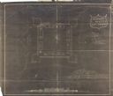
| Description: | This is a photostat copy of a manuscript map in the National Archives showing a plan of Fort Howard and a view of its north side. Originally surveyed by Wi... |

| Date: | 1862 |
|---|---|
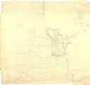
| Description: | This map shows landownership on a military reserve, private claims, buildings (including Fort Howard and U.S. sawmill), swamps, public barns and fields, an... |

| Date: | 1919 |
|---|---|
| Description: | Exterior view from field across pond towards Alfred Lawson's aircraft plant, with buildings and smokestacks. Men are working with a pile of lumber on the l... |
If you didn't find the material you searched for, our Library Reference Staff can help.
Call our reference desk at 608-264-6535 or email us at: