 Filter: Categories of Wisconsin Historical Images
Filter: FORMAT_DIMENSIONS of ? x ?
Filter: Year of 1700-1799
Filter: Year of 1780-1789
Filter: Categories of Wisconsin Historical Images
Filter: FORMAT_DIMENSIONS of ? x ?
Filter: Year of 1700-1799
Filter: Year of 1780-1789

| Date: | 1780 |
|---|---|
| Description: | Hand-drawn plan for the layout of the town of Clarksville, bordering Mayfield Creek and Liberty Creek. Fort Jefferson is shown between the townsite and the... |

| Date: | 1780 |
|---|---|
| Description: | Plan for layout of 150,00 acres which make up Clark's Illinois Grant. |
| Date: | 03 15 1783 |
|---|---|
| Description: | Letter written by Gilbert Imlay regarding Daniel Boone. |
| Date: | 1786 |
|---|---|
| Description: | Body of a letter written by Gilbert Imlay to Colonel Daniel Boone. |
| Date: | 1786 |
|---|---|
| Description: | Letter written by Gilbert Imlay to Daniel Boone. |

| Date: | 1784 |
|---|---|
| Description: | Plate 41. Scene from Cook's Third Expedition, 1776-1779, while in Alaska. |
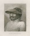
| Date: | 1784 |
|---|---|
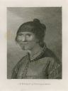
| Description: | Plate 48. Portrait from Cook's Third Expedition, 1776-1779, while in Alaska. |
| Date: | 1784 |
|---|---|
| Description: | Plate 49. Portrait from Cook's Third Expedition, 1776-1779, while in Alaska. |

| Date: | 1784 |
|---|---|
| Description: | Plate 57. Scene from Cook's Third Expedition, 1776-1779, while in Alaska. |
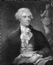
| Date: | 1786 |
|---|---|
| Description: | Portrait engraving of Thomas Jefferson, from the painting by M. Brown. |

| Date: | 1780 |
|---|---|
| Description: | Contenant: New Hampshire, Massachusetsbaye, Rhode Island, Connecticut, La Nouvelle York, Nouvelle Jersey, La Pensilvanie, Les Comtes de Newcastle, Kent et ... |

| Date: | 1784 |
|---|---|
| Description: | Map of The United States of America according to the Treaty of Peace of 1784. |
| Date: | 1783 |
|---|---|
| Description: | Letter from Thomas Jefferson to George Rogers Clark suggesting a transcontinental expedition. |
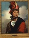
| Date: | 1786 |
|---|---|
| Description: | Print of a Gilbert Stuart painted portrait of Thayendangea (known also as Joseph Brant). He wears a feathered headdress and a shell around his neck. |

| Date: | 09 19 1787 |
|---|---|
| Description: | The first printing of the United States Constitution found in the "Pennsylvania Packet," and "Daily Advertiser." |

| Date: | 09 19 1787 |
|---|---|
| Description: | The first printing of the United States Constitution found in the "Pennsylvania Packet," and "Daily Advertiser." |
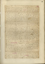
| Date: | 08 11 1781 |
|---|---|
| Description: | The front page of a letter written by Thomas Lewis to William Preston. From Preston and Virginia Papers [Calendar series Volume 1]: "Rockingham. Let... |
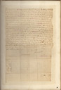
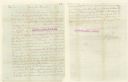
| Date: | 08 1781 |
|---|---|
| Description: | The second page of a letter written by Thomas Lewis to Col. William Preston. From Preston and Virginia Papers [Calendar series Volume 1]: "Rockingha... |

| Date: | 1786 |
|---|---|
| Description: | This map is an updated version of d'Anville's 1761 map of the western hemisphere. He included more details to the north west coast of North America, partic... |
If you didn't find the material you searched for, our Library Reference Staff can help.
Call our reference desk at 608-264-6535 or email us at:
