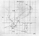
| Date: | 1833 |
|---|---|
| Description: | Township/section map showing Rodolf land and nearby neighbors. |

| Date: | 1890 |
|---|---|
| Description: | Bird's-eye map of West Superior and Superior, with insets of Wright Farm and First Building in Superior. |

| Date: | 1881 |
|---|---|
| Description: | A brochure with a map of Wisconsin that also includes information (in English, German, Norwegian, and Swedish) pertaining to the state, such as its timber ... |
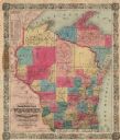
| Date: | 1854 |
|---|---|
| Description: | Brightly-colored map exhaustively marks the townships, County Towns and villages of Wisconsin. It also shows rivers, canals, railroads, and plank roads. Ea... |
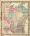
| Date: | 1855 |
|---|---|
| Description: | Drawn seven years after Wisconsin entered statehood, this map shows the counties, cities, towns, rivers and lakes in the entire state. The map includes a c... |
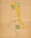
| Date: | 1882 |
|---|---|
| Description: | This manuscript map from 1882 shows land use and land for sale in a portion of the Town of Pewaukee, Waukesha County, Wisconsin. Woods, marshland, springs,... |
| Date: | 1898 |
|---|---|
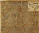
| Description: | This 1898 map of Sawyer County, Wisconsin, shows the township and range system, sections, roads, farm houses, camps, school houses, dams, bridges, Indian r... |
| Date: | 1890 |
|---|---|
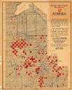
| Description: | This map shows the Wisconsin Central Railroad land grant lands owned and for sale by the Soo Line in Ashland County, Wisconsin, as well as in portions of B... |

| Date: | 1890 |
|---|---|
| Description: | This 1890s map shows the Wisconsin Central Railroad land grant lands owned and for sale by the Soo Line in Ashland County, Wisconsin, as well as in the eas... |
| Date: | 1867 |
|---|---|
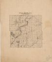
| Description: | This 1867 map shows the Chippewa River in northern Chippewa County, Wisconsin, from just north of Cornell to Jim Falls. Covering portions of the towns of A... |

| Date: | 1847 |
|---|---|
| Description: | Shows parts of northeastern Iowa County, northwestern Dane County, and the extreme southern part of Sauk County "shewing the position of the British Temper... |
| Date: | 1890 |
|---|---|
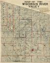
| Description: | Shows vacant state land, government land, townships, and selected farms, camps, saw mills, etc. in Vilas and Oneida Counties, and part of Iron County. "For... |

| Date: | 1879 |
|---|---|
| Description: | This hand-colored profile shows the depth and the fall of an approximately 14 mile long stretch of the Beaver Dam and Crawfish rivers in the towns of Lowel... |
| Date: | 1876 |
|---|---|
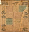
| Description: | Map shows townships and sections, landownership and acreages, roads, railroads, post offices, and farms. Sections appear in pink, yellow, and blue. On the ... |

| Date: | 1892 |
|---|---|
| Description: | Map shows farms, schools, saw mills, townships, railroads, and roads. Counties are labelled and are outlined in yellow and pink. On the upper right and le... |

| Date: | 08 27 1825 |
|---|---|
| Description: | Map is ink on paper. Map shows plat of the town of Munnomunne, the Fox River, farm lots, and an established highway. The map is signed by "J.D. Doty, Propr... |

| Date: | 1871 |
|---|---|
| Description: | This map shows buildings, roads, the railroad, an orchard, and swamp land. Relief shown by hachures. The map includes an index of buildings in the upper ri... |

| Date: | 1855 |
|---|---|
| Description: | This map is ink, pencil, and color on paper and shows property owners, a cemetery, farms, hotels, roads, a dike and on the back are additional notes. Notes... |

| Date: | 1830 |
|---|---|
| Description: | This map is ink, color, and pencil on paper and shows streets, farm lots, and a church. Handwritten notes are at the bottom of the map and are very light. |
If you didn't find the material you searched for, our Library Reference Staff can help.
Call our reference desk at 608-264-6535 or email us at: