 Filter: Categories of Wisconsin Historical Images
Filter: Subject of Fields (Agriculture)
Filter: Subject of water
Filter: Subject of arts
Filter: Categories of Wisconsin Historical Images
Filter: Subject of Fields (Agriculture)
Filter: Subject of water
Filter: Subject of arts

| Date: | 1884 |
|---|---|
| Description: | Bird's-eye view drawing of the grounds of Villa Louis, the estate of the fur trading Dousman family. After the death of H. Louis Dousman's mother in 1882, ... |
| Date: | 1913 |
|---|---|
| Description: | Photographic mock-up for an Alfred Stanley Johnson photomontage postcard entitled "Kickers." A boy wearing waders and holding a rifle stands with his arms ... |

| Date: | |
|---|---|
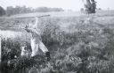
| Description: | A group of men and boys pose by a pond. A boy holds a long, probably bamboo, fishing rod. Two men jokingly pose as if they are dancing the tango. |
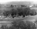
| Date: | 05 30 1967 |
|---|---|
| Description: | View of a parade traveling through a cemetery. Beyond, barns and farmhouses can be seen. |
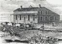
| Date: | 1840 |
|---|---|
| Description: | Sod-breaker and five yoke of oxen plowing in front of the “Old Cottage Inn.” In the foreground a boat is on the shoreline. |
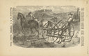
| Date: | 1880 |
|---|---|
| Description: | Front page of booklet with an engraving of a man with a team of two horses in a field with the "Celebrated Gorham Sulky Cultivator." |

| Date: | 1937 |
|---|---|
| Description: | Pictorial map showing historical events and locations within the state of Wisconsin, as well as waterways and counties. Original caption on the bottom marg... |

| Date: | 04 2014 |
|---|---|
| Description: | View down sidewalk towards the Holy Wisdom Monastery. In the distance is Lake Mendota, which is just beyond a field of tall grass and trees. The building h... |

| Date: | 03 1777 |
|---|---|
| Description: | Map showing the British and Hessian attack on Fort Washington in November of 1776. The movements and fortifications of the British and Hessian troops appea... |

| Date: | 1776 |
|---|---|
| Description: | Fairly detailed map of New York City and parts of Long Island. It shows streets, roads, wharves, ferries, ship yards, Fort George and the battery, public b... |

| Date: | 1900 |
|---|---|
| Description: | Three photographs taped together form a panoramic view from the top of the wooden tower built by George Brumder in 1892. The tower was built on Brumder's s... |
If you didn't find the material you searched for, our Library Reference Staff can help.
Call our reference desk at 608-264-6535 or email us at: