 Filter: Categories of Wisconsin Historical Images
Filter: Subject of Indians of North America
Filter: Type of Map or Atlas
Filter: Subject of military art and science
Filter: Categories of Wisconsin Historical Images
Filter: Subject of Indians of North America
Filter: Type of Map or Atlas
Filter: Subject of military art and science

| Date: | 1936 |
|---|---|
| Description: | This map is red and black ink on tracing cloth and is oriented with north to the upper left. This hand-drawn map shows a central portion of the military ro... |

| Date: | 1941 |
|---|---|
| Description: | This pictorial map of Wisconsin with historical text highlights the history of the state and identifies places of interest, Indian villages, missions, trad... |

| Date: | 1846 |
|---|---|
| Description: | A hand-colored map of Wisconsin shows the counties in the state south and east of the Wisconsin and Fox rivers and the locations of Indian lands to the nor... |

| Date: | 1848 |
|---|---|
| Description: | Map of Wisconsin and a portion of Minnesota showing the township surveys in progress in portions of the Saint Croix River region and in central Wisconsin a... |

| Date: | 1860 |
|---|---|
| Description: | A survey map of Wisconsin, southeastern Minnesota, and northern Iowa, showing the status of surveys, rivers, and lakes. The map also shows the locations of... |

| Date: | 1847 |
|---|---|
| Description: | A hand-colored map that shows the area south and east of the Wisconsin and Fox Rivers, as well as a few landmarks just north of that area. The township gri... |

| Date: | |
|---|---|
| Description: | A map of southern Wisconsin and northern Illinois showing where the battles took place and routes taken by Black Hawk and his band during the Black Hawk Wa... |

| Date: | 1931 |
|---|---|
| Description: | This U.S. Geological Survey map of Wisconsin shows counties, cities and villages, lighthouses, Indian reservations, military reservations, and bird and gam... |

| Date: | 1912 |
|---|---|
| Description: | This map from the U.S. General Land Office shows railroads, counties, cities and villages, rivers, lakes, U.S. Land Offices, Indian reservations, military ... |

| Date: | 1911 |
|---|---|
| Description: | This hand-colored map is a 1911 copy of a map drawn by Gaspard-Joseph Chaussegros de Léry in 1730 showing the Fox River from its mouth at Green Bay to Lake... |
| Date: | 1835 |
|---|---|
| Description: | This map covers the Western Territory of the United States from the Rocky Mountains in Colorado south to Fort Smith, Arkansas, and from the Pacific Ocean e... |

| Date: | 1800 |
|---|---|
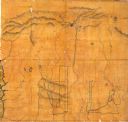
| Description: | This map is pencil on tracing paper and shows marshes, the Wisconsin River, Indian trails, and Indian boundary line. The upper left corner reads: "Let sect... |

| Date: | |
|---|---|
| Description: | This map is pen-and-ink on tracing paper with a mounted legend and shows the Kickapoo River, Indian mounds, the 1st Fort Crawford, an Indian Agency, the si... |

| Date: | 1853 |
|---|---|
| Description: | This map shows camps, forts, logging camps, lakes, roads, railroads, the Wisconsin River, and Lac Du Flambeau Indian Reservation. Some points of interest a... |

| Date: | 1760 |
|---|---|
| Description: | This map shows lakes, rivers, forts, settlements, and Native American tribal territory. The southern boundary of the Hudsons Bay Company is labeled. Relief... |

| Date: | 1837 |
|---|---|
| Description: | This map shows planned military posts/depots, barracks, rivers, lakes, roads, existing forts, and land assigned to various Indian tribes. Arkansas, Illinoi... |
| Date: | 1836 |
|---|---|
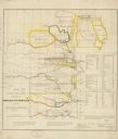
| Description: | This map shows rivers, roads, military posts, and geographical locations by tribe. Includes treaty notes and tables of Indian population statistics by trib... |

| Date: | 1946 |
|---|---|
| Description: | This map shows scenes from America's history with names of historical events superimposed on a map of the United States. |

| Date: | 1900 |
|---|---|
| Description: | This map shows the boundary lines between ceded and unceded land in compliance with the Treaty of Prairie du Chen of 1829. It also shows roads, rivers, por... |

| Date: | 1846 |
|---|---|
| Description: | This map shows the plotting of the various townships in Wisconsin, both those that had been surveyed and some outlines for those which have not. A note in ... |
If you didn't find the material you searched for, our Library Reference Staff can help.
Call our reference desk at 608-264-6535 or email us at: