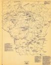
| Date: | 1962 |
|---|---|
| Description: | A map showing the location of Indian settlements in Wisconsin, indicating the settlements of the Chippewa, or Ojibwe, at St. Croix, Lac Courte Oreilles, Re... |

| Date: | 1960 |
|---|---|
| Description: | This manuscript map of Taylor County, Wisconsin, shows the township and range grid, lakes and streams, "Chippewa trails, Indian trails" Indian villages and... |

| Date: | 1969 |
|---|---|
| Description: | This map shows ghost towns, Indian reservations, lakes, railroads, and rivers. Ghost towns are numbered and listed in a corresponding index. |

| Date: | 1967 |
|---|---|
| Description: | This colored map published by the State Historical Society of Wisconsin shows key points of interest telling the story of Wisconsin's earliest settlement a... |

| Date: | 1962 |
|---|---|
| Description: | This colored map represents "Tour #2" of a series of driving tours of the state published by the Sperry & Hutchinson Company, in order to "help you enjoy W... |

| Date: | 1962 |
|---|---|
| Description: | This colored map represents "Tour #1" of a series of driving tours of the state published by the Sperry & Hutchinson Company, in order to "help you enjoy W... |

| Date: | 1969 |
|---|---|
| Description: | A map of Wisconsin from The Atlas of the Eight Counties of Forest, Florence, Iron, Langlade, Lincoln, Oneida, Price, Vilas. The map shows rivers and a vari... |
If you didn't find the material you searched for, our Library Reference Staff can help.
Call our reference desk at 608-264-6535 or email us at: