| Date: | |
|---|---|
| Description: | Map of the district of the Peshtigo fire, approximately 1,280,000 acres, in Wisconsin and Upper Michigan. |

| Date: | 1916 |
|---|---|
| Description: | This version of a 1916 Wisconsin Conservation Commission map shows Peninsula State Park in the Town of Gibraltar, Door County, Wisconsin. Depicted are open... |

| Date: | 1746 |
|---|---|
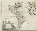
| Description: | Detailed map of the western hemisphere and part of Africa and Europe. Islands, cities, settlements, rivers, lakes, countries, and regions are marked. Mount... |
If you didn't find the material you searched for, our Library Reference Staff can help.
Call our reference desk at 608-264-6535 or email us at: