 Filter: Categories of Wisconsin Historical Images
Filter: Subject of Land companies
Filter: Subject of railroads
Filter: Year of 1800-1899
Filter: Categories of Wisconsin Historical Images
Filter: Subject of Land companies
Filter: Subject of railroads
Filter: Year of 1800-1899

| Date: | 1886 |
|---|---|
| Description: | Wisconsin map showing land offices, railroads completed, railroad land grants and Indian reservations. |

| Date: | 1896 |
|---|---|
| Description: | This hand-colored map shows counties, county seats, cities, towns, proposed and completed railroads, and U.S. Land Offices. Also included in the map are th... |

| Date: | 1896 |
|---|---|
| Description: | A map showing the Wisconsin Central Railroad lines in Wisconsin, northern Illinois, eastern Minnesota, and Michigan’s Upper Peninsula. The area of the map ... |

| Date: | 1864 |
|---|---|
| Description: | A hand-colored survey map of southeastern Minnesota and Wisconsin, showing the locations of railroads, land grant railroads, land offices, and the 6 and 15... |

| Date: | 1881 |
|---|---|
| Description: | A brochure with a map of Wisconsin that also includes information (in English, German, Norwegian, and Swedish) pertaining to the state, such as its timber ... |
| Date: | 1888 |
|---|---|
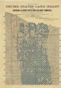
| Description: | Map of northern Wisconsin showing the Chicago and North-Western Railway Company’s land grants within the counties of Forest, Florence, Langlade, Marinette,... |

| Date: | 1875 |
|---|---|
| Description: | This manuscript map shows the limits of the land grants made to railroads in northwestern Wisconsin along the corridor between Portage and Hudson, along th... |

| Date: | 1874 |
|---|---|
| Description: | This map shows townships and sections, post offices, roads, and railroads. The left margin reads: "For sale at Cushing Land Agency, St. Croix Falls, Wis. 4... |
If you didn't find the material you searched for, our Library Reference Staff can help.
Call our reference desk at 608-264-6535 or email us at: