 Filter: Community of Washburn
| Date: | |
|---|---|
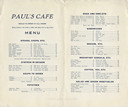
| Description: | Interior of the Paul's Cafe menu, with "Meals to order at all hours." |
| Date: | |
|---|---|
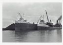
| Description: | View across water towards ships unloading coal and sulphur. Cranes rise above both ships, and a man is walking near a large pile of coal in the background ... |
| Date: | |
|---|---|
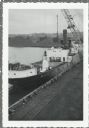
| Description: | Elevated view over railroads tracks of Canadian ship with cargo of wood pulp. Sulphide bales are being unloaded and there are several men on the ship. In t... |
| Date: | |
|---|---|
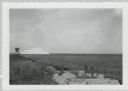
| Description: | View from shoreline of dock site towards Lake Superior, showing sulphur pile and a large chute in the background. |

| Date: | 1918 |
|---|---|
| Description: | Manuscript map of the Chequamegon Bay area on Lake Superior drawn by Warren W. Witmer and illustrated with sketches by Mary L. Wright Witmer in ink and wat... |
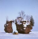
| Date: | |
|---|---|
| Description: | View across frozen bay towards a person riding a snowmobile in front of a split rock formation on Chequamegon Bay. |

| Date: | |
|---|---|
| Description: | View looking downhill between two boys in the foreground sitting on logs on the left and right. Another person is walking up the hill path. Below is a grou... |
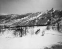
| Date: | 1951 |
|---|---|
| Description: | View across valley of Mt. Valhalla, a ski hill with two ski jumps. |
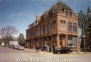
| Date: | 1990 |
|---|---|
| Description: | Text on front reads: "Washburn, Wisconsin." On reverse: "Washburn Historical Museum and Cultural Center. National Register of Historical Places. Washburn, ... |

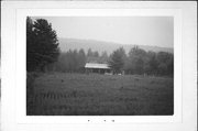
| Date: | 1950 |
|---|---|
| Description: | Text on front reads: "Sioux River." On reverse: "Big Rock on Sioux River. Washburn, Wisconsin. A thrilling day of trout fishing and picnicking at the Big R... |

| Date: | 09 1918 |
|---|---|
| Description: | An insurance map of Washburn, with an index and a key. Includes a small inset map of the State of Wisconsin that shows "Location of this town as above unde... |

| Community: | Washburn |
|---|---|
| County: | Bayfield |
| Historic Name: | |
| Reference Number: | 1046 |
| Community: | Washburn |
|---|---|
| County: | Bayfield |
| Historic Name: | |
| Reference Number: | 1063 |
| Community: | Washburn |
|---|---|
| County: | Bayfield |
| Historic Name: | |
| Reference Number: | 1064 |
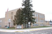
| Community: | Washburn |
|---|---|
| County: | Bayfield |
| Historic Name: | DUPONT SCHOOL |
| Reference Number: | 120732 |
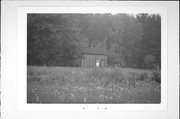
| Community: | Washburn |
|---|---|
| County: | Bayfield |
| Historic Name: | Memorial Park |
| Reference Number: | 133718 |
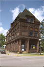
| Community: | Washburn |
|---|---|
| County: | Bayfield |
| Historic Name: | BAYFIELD COUNTY BANK |
| Reference Number: | 1464 |
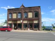
| Community: | Washburn |
|---|---|
| County: | Bayfield |
| Historic Name: | Bank of Washburn |
| Reference Number: | 1466 |
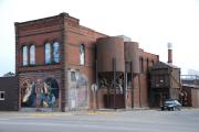
| Community: | Washburn |
|---|---|
| County: | Bayfield |
| Historic Name: | Union Block / Meehan Mercantile Company |
| Reference Number: | 1467 |
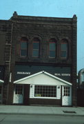
| Community: | Washburn |
|---|---|
| County: | Bayfield |
| Historic Name: | W. H. LEMKE DRYGOODS |
| Reference Number: | 1468 |
If you didn't find the material you searched for, our Library Reference Staff can help.
Call our reference desk at 608-264-6535 or email us at: