 Filter: Subject of Indians of North America
Filter: Type of Map or Atlas
Filter: Subject of Indians of North America
Filter: Type of Map or Atlas

| Date: | 1956 |
|---|---|
| Description: | This map shows reservation boundaries, U.S. township lines, highways, roads, rivers, and lakes. The lower left corner of the map includes a legend of "Conv... |

| Date: | 1853 |
|---|---|
| Description: | This map shows camps, forts, logging camps, lakes, roads, railroads, the Wisconsin River, and Lac Du Flambeau Indian Reservation. Some points of interest a... |

| Date: | 1930 |
|---|---|
| Description: | Original map made with watercolor and inkwash. Includes a legend of buildings, roads, natural features and other details of the lodge. Inset at bottom has ... |

| Date: | 10 1911 |
|---|---|
| Description: | This map shows lot numbers, building lines, roads, trees, and Indian mounds. Relief is shown by contours. Includes manuscript annotations marking parks. |

| Date: | 1969 |
|---|---|
| Description: | This map shows ghost towns, Indian reservations, lakes, railroads, and rivers. Ghost towns are numbered and listed in a corresponding index. |

| Date: | 1760 |
|---|---|
| Description: | This map shows lakes, rivers, forts, settlements, and Native American tribal territory. The southern boundary of the Hudsons Bay Company is labeled. Relief... |

| Date: | 1911 |
|---|---|
| Description: | This map shows swamps, railroads, rivers, roads, the Catholic Mission Reserve, the day school, and the Agency Reserve. Lake Superior is labeled. An inset m... |

| Date: | 1845 |
|---|---|
| Description: | This map shows lakes, rivers, Chippewa land, the U.S. Mineral Land Agency, boundary between U.S. and Canada, Methodist and Catholic missions, and American ... |

| Date: | 1949 |
|---|---|
| Description: | This pictorial map shows the United States west of the Mississippi, including Indian Tribes, historic trails, forts, trading posts, mountain ranges, lakes ... |
| Date: | 1834 |
|---|---|
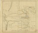
| Description: | This map shows the locations of Indian tribes, and lands sold and ceded, as well as roads, forts, and rivers. Lands in the Great Plains are covered, and Ar... |

| Date: | 1837 |
|---|---|
| Description: | This map shows planned military posts/depots, barracks, rivers, lakes, roads, existing forts, and land assigned to various Indian tribes. Arkansas, Illinoi... |

| Date: | 1948 |
|---|---|
| Description: | This illustrated map shows major westward trails from 1785 to 1866: Old Oregon Trail and its deviations, Old Spanish Trail, Lewis and Clark route, Santa Fe... |
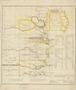
| Date: | 1836 |
|---|---|
| Description: | This map shows rivers, roads, military posts, and geographical locations by tribe. Includes treaty notes and tables of Indian population statistics by trib... |

| Date: | 1974 |
|---|---|
| Description: | Map of Wisconsin with drawings illustrating historic places and events throughout the state. The Great Seal of the State of Wisconsin appears at the top ri... |

| Date: | 1911 |
|---|---|
| Description: | This map shows lakes, rivers, swamps, state swamp land, trails and railroads. Includes a township diagram. |

| Date: | 1912 |
|---|---|
| Description: | This map shows a school reserve, swamp land, railroads, and selected buildings. |

| Date: | 1851 |
|---|---|
| Description: | This map shows townships, villages, Indian villages, railroads, roads, mills, prairies, swamps, and canals. An inset map shows a plat of the copper distric... |

| Date: | 1911 |
|---|---|
| Description: | This map shows railroads, roads, swamps, a school site and farm, and a mill site. The map includes a "typical township" diagram. Lac du Flambeau, Long Lake... |

| Date: | 1935 |
|---|---|
| Description: | This map shows railroads, telephone lines, roads, trails, schools, sub-agency, lookout stations, churches, community centers, and school site and farm. Bil... |

| Date: | 1935 |
|---|---|
| Description: | This map shows the state trunk highway system and county trunk highways. This map show surface type on state and county trunk highways and the locations of... |
If you didn't find the material you searched for, our Library Reference Staff can help.
Call our reference desk at 608-264-6535 or email us at: