| Date: | 1823 |
|---|---|
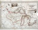
| Description: | In 1823 U.S. Army major Stephen H. Long led an expedition of scientific, trade, and military investigation up the Mississippi River and the Red River of th... |

| Date: | 1886 |
|---|---|
| Description: | Bird's-eye view of Ashland, on the shores of Lake Superior, with insets of The Apostle Islands Chequamagon Bay & Ashland, and Distances from Ashland. |

| Date: | 1890 |
|---|---|
| Description: | Bird's-eye map of Ashland, viewed from Lake Superior, with insets of Prentice Park and Fishery. Population 16,000. Increase in Ten Years, 11,000. |

| Date: | 1886 |
|---|---|
| Description: | Bird's-eye view of Bayfield, county seat of Bayfield County. On the lower left side is an inset for Bayfield and the Apostle Islands. |

| Date: | 1883 |
|---|---|
| Description: | Bird's-eye map of Superior, county seat of Douglas County, on the shores of Lake Superior, with insets of points of interest. |

| Date: | 1886 |
|---|---|
| Description: | Bird's-eye map of Washburn on Lake Superior. There is an inset of Washburn, Chequamagon and the Apostle Islands. |

| Date: | 1887 |
|---|---|
| Description: | Bird's-eye view of Superior, on Lake Superior. |

| Date: | 1890 |
|---|---|
| Description: | Bird's-eye map of West Superior and Superior, with insets of Wright Farm and First Building in Superior. |

| Date: | 1896 |
|---|---|
| Description: | Bird's-eye view of Washburn, with twenty vignettes around side, water in foreground with docks and lumber corral. Thirty-three locations identified in key ... |

| Date: | 02 26 1887 |
|---|---|
| Description: | Bird's-eye map of Ashland, and the Apostle Islands in Lake Superior. Caption reads: "Ashland and the Apostle Islands." |

| Date: | 1884 |
|---|---|
| Description: | Panorama bird's-eye view of the town of Ashland, on Lake Superior, and the Apostle Islands. |

| Date: | 1865 |
|---|---|
| Description: | Map showing the location of meteorological stations and effects that Lake Michigan has had on Wisconsin temperatures in January and July. The map shows cou... |

| Date: | 1820 |
|---|---|
| Description: | Map of the Northwestern Territories of the United State showing the track pursued by the Expedition in 1820. |

| Date: | 1870 |
|---|---|
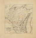
| Description: | A geological survey map of Wisconsin, with hand-colored portions showing the surveys completed from 1873 to 1875. Although the title and legend are in Wel... |

| Date: | 1872 |
|---|---|
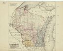
| Description: | A series of four hand-colored, geological maps of Wisconsin. Starting from the top of the page, the first map is of a section along the line of the 4th pri... |

| Date: | 1858 |
|---|---|
| Description: | Front cover of a guide book describing Bayfield and an account of a pleasure tour to Lake Superior. The title is surrounded by a decorative border with flo... |

| Date: | 1874 |
|---|---|
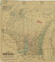
| Description: | A hand-colored, geological map of Wisconsin show the progress of the state geological survey in 1873 and 1874. Other elements displayed in the map include... |

| Date: | 1898 |
|---|---|
| Description: | This map shows the conditions of the forest. Includes a color legend in left margin, depicting the various conditions. Original caption reads, "Compiled by... |

| Date: | 1862 |
|---|---|
| Description: | This map shows the population by county, the basic geology, climate, and the distribution of timber within the state of Wisconsin. It shows mean seasonal t... |

| Date: | 1870 |
|---|---|
| Description: | This map is mostly pencil on paper map but includes latitude and longitude grid in ink. The map covers the Mississippi River from Lake Itasca to the Wiscon... |
If you didn't find the material you searched for, our Library Reference Staff can help.
Call our reference desk at 608-264-6535 or email us at: