Filter: Year of 1800-1899
Filter: Subject of cities and towns
Filter: Type of Map or Atlas
Filter: County of Winnebago
Filter: Year of 1800-1899
Filter: Subject of cities and towns
Filter: Type of Map or Atlas
Filter: County of Winnebago

| Date: | 1870 |
|---|---|
| Description: | This bird's-eye-view map shows roads, a river with boats, and homes. The bottom margin of the map includes an index. |

| Date: | 1850 |
|---|---|
| Description: | Bird's-eye view of business district of Oshkosh, "drawn after nature" by the artist. |

| Date: | 1867 |
|---|---|
| Description: | Bird's-eye view of Oshkosh, "drawn from nature." |

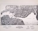
| Date: | 1875 |
|---|---|
| Description: | Bird's-eye map after a fire destroyed a large area of the town. In memory of the Great Conflagration on April 28th, 1875. Taken from the North-Side. |
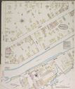
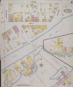
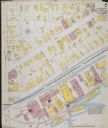
| Date: | 1884 |
|---|---|
| Description: | Sanborn-Perris fire insurance map for city of Menasha. |
| Date: | 1884 |
|---|---|
| Description: | Sanborn-Perris fire insurance map for city of Menasha. |
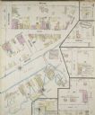
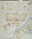
| Date: | 1887 |
|---|---|
| Description: | Sanborn-Perris fire insurance maps for city of Menasha. |
| Date: | 1887 |
|---|---|
| Description: | Sanborn-Perris fire insurance maps for city of Menasha. |
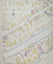
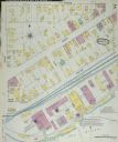
| Date: | 1891 |
|---|---|
| Description: | Sanborn-Perris fire insurance maps for city of Menasha. |
| Date: | 1891 |
|---|---|
| Description: | Sanborn-Perris fire insurance maps for city of Menasha. |
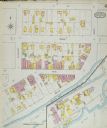
| Date: | 1895 |
|---|---|
| Description: | Sanborn-Perris fire insurance maps for city of Menasha. |
| Date: | 1895 |
|---|---|
| Description: | Sanborn-Perris fire insurance maps for city of Menasha. |

| Date: | 1862 |
|---|---|
| Description: | This 1862 map of Winnebago County, Wisconsin, shows the township and range grid, towns, sections, cities and villages, railroads, roads, property owners an... |

| Date: | 1855 |
|---|---|
| Description: | This 1855 map of Winnebago County, Wisconsin, shows the township and range grid, towns, cities, villages, and post offices, roads, and lakes and streams. |

| Date: | 1873 |
|---|---|
| Description: | This 1873 map of Winnebago County, Wisconsin, shows the township and range grid, towns, sections, cities and villages, landownership and acreages, roads, r... |

| Date: | 1897 |
|---|---|
| Description: | This 1897 map of Winnebago County, Wisconsin, shows the township and range grid, towns, sections, cities and villages, landownership and acreages, rural re... |

| Date: | 1881 |
|---|---|
| Description: | Ink, watercolor, and pencil on paper. Top of the map reads: "NORTHERN OUTLET MENASHA MEANDER LINES Scale 132ft 1 INCH Var S.E. Survey Completed Spet. 23 18... |
If you didn't find the material you searched for, our Library Reference Staff can help.
Call our reference desk at 608-264-6535 or email us at: