| Date: | 1875 |
|---|---|
| Description: | A hand-drawn and colored map of Wisconsin showing the railroad routs and railroad land grants La Cross and Milwaukee Railroad, St. Croix and Tomah Railroad... |

| Date: | 1880 |
|---|---|
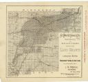
| Description: | This map covers parts of Minnesota, Iowa, and South Dakota and advertised 1,000,000 acres of land available. Communities, roads, and railroad lines are lab... |

| Date: | 1896 |
|---|---|
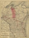
| Description: | A map showing the Wisconsin Central Railroad lines in Wisconsin, northern Illinois, eastern Minnesota, and Michigan’s Upper Peninsula. The area of the map ... |
If you didn't find the material you searched for, our Library Reference Staff can help.
Call our reference desk at 608-264-6535 or email us at: