 Search: public
Filter: Community of Milwaukee
Filter: Type of Map or Atlas
Search: public
Filter: Community of Milwaukee
Filter: Type of Map or Atlas

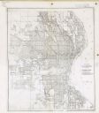
| Date: | 1863 |
|---|---|
| Description: | Includes index to public buildings, churches, schools. Inset: Glidden & Lockwood’s addition. Gives names of some property owners. |

| Date: | 1888 |
|---|---|
| Description: | This map shows city wards, block numbers, parks, cemeteries, roads, railroads, and selected buildings. The map includes indexes to streets, public building... |

| Date: | 1887 |
|---|---|
| Description: | This map shows block numbers, roads, railroads, wards, and selected buildings. The map includes a "Milwaukee city street guide" and index to public buildin... |

| Date: | 1890 |
|---|---|
| Description: | This map shows city wards, block numbers, parks, cemeteries, roads, railroads, and selected buildings. The map includes indexes to streets, public building... |

| Date: | 1893 |
|---|---|
| Description: | This map shows city wards, block numbers, parks, cemeteries, roads, railroads, selected buildings, and Lake Michigan. Also included are indexes to streets,... |

| Date: | 1927 |
|---|---|
| Description: | This map shows street car lines, bus routes, railroads, proposed city boundary lines, wards, public schools, blocks & house numbers, Lake Michigan, one mil... |

| Date: | 1901 |
|---|---|
| Description: | This map shows public schools, engine houses, railroads, street railways, city wards, parks, block numbers, and Lake Michigan. Also included are indexes, t... |

| Date: | 1886 |
|---|---|
| Description: | A hand-colored map of Milwaukee County, Wisconsin that shows the township and range system, sections, towns, roads, railroads and rail stations, cities and... |

| Date: | 1891 |
|---|---|
| Description: | A hand-colored map of Milwaukee County, Wisconsin that shows the township and range system, sections, towns, roads, railroads and rail stations, cities and... |

| Date: | 05 1958 |
|---|---|
| Description: | Photocopy of a map created by the City of Milwaukee Master Plan Program City Planning Division in May of 1958 representing 1870 "THE CENTRAL AREA OF THE CI... |

| Date: | 1902 |
|---|---|
| Description: | A map of Milwaukee County, Wisconsin that shows the township and range system, sections, towns, roads, railroads and rail stations, cities and villages, po... |

| Date: | 1902 |
|---|---|
| Description: | This map is a chart of Milwaukee Harbor that displays local streets, bridges, roads, railroads, public buildings, businesses, factories, dry docks, parks, ... |
| Date: | 12 11 1933 |
|---|---|
| Description: | This map shows residence, business, commercial, and industrial districts as well as streets, points of interest, and Lake Michigan. |

| Date: | 1897 |
|---|---|
| Description: | This map shows city wards, block numbers, parks, cemeteries, roads, railroads, Lake Michigan, and selected buildings. Also included are indexes to streets,... |

| Date: | 1911 |
|---|---|
| Description: | This map shows city wards, block numbers, parks, cemeteries, roads, railroads, Lake Michigan, and selected buildings. Also included are indexes "Milwaukee ... |

| Date: | 1907 |
|---|---|
| Description: | This map is a chart of Milwaukee Harbor that displays local streets, bridges, roads, railroads, public buildings, businesses, factories, dry docks, parks, ... |

| Date: | 1898 |
|---|---|
| Description: | This map shows city wards, block numbers, parks, cemeteries, roads, railroads, Lake Michigan, and selected buildings. Also included are indexes "Milwaukee ... |

| Date: | 1900 |
|---|---|
| Description: | This map shows city wards, block numbers, parks, cemeteries, roads, railroads, Lake Michigan, and selected buildings. Also included are indexes "Milwaukee ... |

| Date: | 1901 |
|---|---|
| Description: | This map shows city wards, block numbers, parks, cemeteries, roads, railroads, Lake Michigan, and selected buildings. Also included are indexes "Milwaukee ... |

| Date: | 2000 |
|---|---|
| Description: | This map shows the industrial area along the Menominee River and canals. Industrial buildings are shown in orange and labeled in red. Other areas are shown... |
If you didn't find the material you searched for, our Library Reference Staff can help.
Call our reference desk at 608-264-6535 or email us at: