
| Date: | |
|---|---|
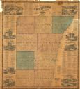
| Description: | Map shows roads, railroads, rivers, and improved farms. Includes text on lands for sale and exchange by B.W. Pulling, successor to Marshfield Land Company.... |
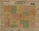
| Date: | 1876 |
|---|---|
| Description: | Map shows townships and sections, landownership and acreages, roads, railroads, post offices, and farms. Sections appear in pink, yellow, and blue. On the ... |
| Date: | 1904 |
|---|---|
| Description: | Map shows townships and sections, landownership and acreages, roads, railroads, post offices, and farms. On the top, bottom, and sides of map are advertise... |

| Date: | 1892 |
|---|---|
| Description: | Map shows farms, schools, saw mills, townships, railroads, and roads. Counties are labelled and are outlined in yellow and pink. On the upper right and le... |

| Date: | 1912 |
|---|---|
| Description: | A plat map of the township of West Kewaunee. |

| Date: | 1878 |
|---|---|
| Description: | An etching of the farm and residence of Mrs. C.E. Packman and her son. |
| Date: | 1854 |
|---|---|
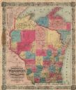
| Description: | Brightly-colored map exhaustively marks the townships, County Towns and villages of Wisconsin. It also shows rivers, canals, railroads, and plank roads. Ea... |
| Date: | 1890 |
|---|---|
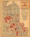
| Description: | This map shows the Wisconsin Central Railroad land grant lands owned and for sale by the Soo Line in Ashland County, Wisconsin, as well as in portions of B... |

| Date: | 1910 |
|---|---|
| Description: | This map shows the Wisconsin Central Railroad land grant lands owned and for sale by the Soo Line in Taylor County, Wisconsin, as well as in southwestern L... |

| Date: | 1890 |
|---|---|
| Description: | This 1890s map shows the Wisconsin Central Railroad land grant lands owned and for sale by the Soo Line in Ashland County, Wisconsin, as well as in the eas... |

| Date: | 1901 |
|---|---|
| Description: | Plat map showing land ownership of Township 21N Range 3W in Jackson County for 1901. Scale is 2 inches to 1 mile. |
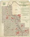
| Date: | 1915 |
|---|---|
| Description: | This map shows school houses, churches, farms, and railroads. Chequamecon Bay and Bad River Indian Reservation are labeld. The map reads: "All lands shown ... |

| Date: | 1909 |
|---|---|
| Description: | Map of Sawyer County with an advertisement for land sales through Fuley & Quail of Hayward, Wisconsin. There is a small inset map of railroads accessible i... |
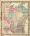
| Date: | 1855 |
|---|---|
| Description: | Drawn seven years after Wisconsin entered statehood, this map shows the counties, cities, towns, rivers and lakes in the entire state. The map includes a c... |

| Date: | 1830 |
|---|---|
| Description: | This map is ink, color, and pencil on paper and shows streets, farm lots, and a church. Handwritten notes are at the bottom of the map and are very light. |
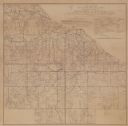
| Date: | 1928 |
|---|---|
| Description: | Shows different types of roads, railroads, schools, churches, farmsteads, cheese factories, mine shafts, old surface workings, streams, old sulphur pits, a... |

| Date: | 1908 |
|---|---|
| Description: | Title at top: "G.F. Sanborn Company Timber and Farming Lands." Map shows acreages, roads, railroads, and swamps in parts of Vilas and Oneida counties. |

| Date: | 08 27 1825 |
|---|---|
| Description: | Map is ink on paper. Map shows plat of the town of Munnomunne, the Fox River, farm lots, and an established highway. The map is signed by "J.D. Doty, Propr... |
If you didn't find the material you searched for, our Library Reference Staff can help.
Call our reference desk at 608-264-6535 or email us at: