 Filter: Categories of Wisconsin Historical Images
Filter: Subject of Land companies
Filter: Type of Map or Atlas
Filter: Year of 1800-1899
Filter: Categories of Wisconsin Historical Images
Filter: Subject of Land companies
Filter: Type of Map or Atlas
Filter: Year of 1800-1899

| Date: | 1836 |
|---|---|
| Description: | Lots to be sold at auction by Van Antwerp and Van Dyke on Monday, 3rd Oct. 1836. The map shows plots and labeled streets. Iowa County was later split and B... |

| Date: | 1886 |
|---|---|
| Description: | Wisconsin map showing land offices, railroads completed, railroad land grants and Indian reservations. |

| Date: | 1896 |
|---|---|
| Description: | This hand-colored map shows counties, county seats, cities, towns, proposed and completed railroads, and U.S. Land Offices. Also included in the map are th... |

| Date: | 1896 |
|---|---|
| Description: | A map showing the Wisconsin Central Railroad lines in Wisconsin, northern Illinois, eastern Minnesota, and Michigan’s Upper Peninsula. The area of the map ... |

| Date: | 1864 |
|---|---|
| Description: | A hand-colored survey map of southeastern Minnesota and Wisconsin, showing the locations of railroads, land grant railroads, land offices, and the 6 and 15... |

| Date: | 1881 |
|---|---|
| Description: | A brochure with a map of Wisconsin that also includes information (in English, German, Norwegian, and Swedish) pertaining to the state, such as its timber ... |
| Date: | 1888 |
|---|---|
| Description: | Map of northern Wisconsin showing the Chicago and North-Western Railway Company’s land grants within the counties of Forest, Florence, Langlade, Marinette,... |

| Date: | 1875 |
|---|---|
| Description: | This manuscript map shows the limits of the land grants made to railroads in northwestern Wisconsin along the corridor between Portage and Hudson, along th... |

| Date: | 1836 |
|---|---|
| Description: | This map of Belmont includes notarization from the justice of the peace of Iowa County, May 15, 1836, acknowledging John Atchison as proprietor of Belmont ... |

| Date: | 1874 |
|---|---|
| Description: | This map shows townships and sections, post offices, roads, and railroads. The left margin reads: "For sale at Cushing Land Agency, St. Croix Falls, Wis. 4... |

| Date: | 1845 |
|---|---|
| Description: | This map shows lakes, rivers, Chippewa land, the U.S. Mineral Land Agency, boundary between U.S. and Canada, Methodist and Catholic missions, and American ... |

| Date: | 1891 |
|---|---|
| Description: | This blueprint manuscript map shows land owned by Green Bay & Mississippi Canal Co., Meade, Vilas, Patten, and Hewitt. Streets and the Fox River are labele... |

| Date: | 1857 |
|---|---|
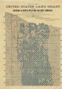
| Description: | Green Lake County Abstract plat map, T. 14 N, R. 11 E. |
If you didn't find the material you searched for, our Library Reference Staff can help.
Call our reference desk at 608-264-6535 or email us at:
