| Date: | |
|---|---|
| Description: | Three-quarter view from front of man driving a Scout up a hill. In the background are houses on a steep hill behind a fence. |

| Date: | |
|---|---|
| Description: | Three-quarter view from front towards a man driving a Scout on a road crossing a stream. Another man is sitting in the passenger seat. |

| Date: | |
|---|---|
| Description: | View looking towards A.G. Zimmerman driving a horseless carriage, or early automobile over a rustic bridge. The bridge has board flooring and railings made... |

| Date: | 1919 |
|---|---|
| Description: | This map shows auto trails, main roads, rivers, and populations of communities. The map also shows selected hotels and garages and includes a key in the ri... |

| Date: | 1950 |
|---|---|
| Description: | Man driving an L-120 truck on a road. The open bed of the truck is piled with sacks of grain. There is a spare tire mounted on the outside of the truck bed... |

| Date: | 1953 |
|---|---|
| Description: | Three-quarter view from front of driver's side of R-110 Truck with pickup body traveling along a road. The bed has raised sides with gates, and two animals... |

| Date: | |
|---|---|
| Description: | View from roadside of an automobile driving up a curve in a road through a large rock formation cut through a bluff. |

| Date: | 1917 |
|---|---|
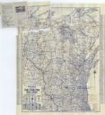
| Description: | This road map shows routes through the state as well as some portions of Iowa, Minnesota, and Michigan. Cities, the Mississippi River, Lake Winnebago, Gree... |

| Date: | 1927 |
|---|---|
| Description: | This map details automobile routes throughout the state as well as parts of Iowa, Minnesota, Michigan and Illinois. Cities, the Mississippi River, Lake Mic... |

| Date: | 1910 |
|---|---|
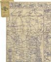
| Description: | This map shows automobile routes across the state as well as Minnesota, Iowa, Illinois, and Michigan. Cities, Lake Michigan, Lake Superior, the Mississippi... |

| Date: | 1920 |
|---|---|
| Description: | This map details automobile routes spanning across Wisconsin and parts of Illinois, Michigan, Minnesota, and Iowa. Cities, counties, Lake Michigan, Lake Su... |

| Date: | 1894 |
|---|---|
| Description: | This map shows automobile routes across the state and into parts of Illinois, Michigan, Minnesota, and Iowa. Cities, counties, Lake Michigan, Lake Superior... |

| Date: | 1913 |
|---|---|
| Description: | This map details automobile routes throughout the state and parts of Illinois, Minnesota, Michigan, and Iowa. Cities, counties, Lake Michigan, Lake Superio... |

| Date: | 1924 |
|---|---|
| Description: | This map shows automobile routes across the state and into parts of Minnesota, Iowa, Illinois, and Michigan. Cities, Lake Michigan, Lake Superior, Green Ba... |

| Date: | 1919 |
|---|---|
| Description: | This map contains the automobile routes in southern Wisconsin and northern Illinois. Cities, Lake Winnebago and Green Bay are labeled. The orange print on ... |

| Date: | 1915 |
|---|---|
| Description: | This map displays various automobile routes through the state of Wisconsin and parts of Illinois, Iowa, Minnesota, and Michigan. Cities, counties, Lake Mic... |

| Date: | 1913 |
|---|---|
| Description: | This map displays automobile routes across Wisconsin as well as Minnesota, Iowa, Michigan and Illinois. Cities, counties, Lake Michigan, Lake Superior, Gre... |

| Date: | 1920 |
|---|---|
| Description: | The map shows the entire state with cities, rivers, and lakes labeled. The upper and right margin include inset maps of Racine, Milwaukee, Waukesha, Applet... |

| Date: | 1930 |
|---|---|
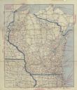
| Description: | This map shows the entire state plus portions of Illinois, Iowa, Minnesota, and Michigan outlined in blue. The map shows roads, state parks (black triangle... |

| Date: | 1956 |
|---|---|
| Description: | Evergreen Road in Peninsula State Park during fall peak season. An automobile is driving up the road. |
If you didn't find the material you searched for, our Library Reference Staff can help.
Call our reference desk at 608-264-6535 or email us at: