
| Date: | 1758 |
|---|---|
| Description: | This map of the north-west hemisphere shows the cities, lakes, rivers, mountains, and political borders. In the upper left corner sits a decorative cartouc... |

| Date: | 1755 |
|---|---|
| Description: | This map shows the eastern half of North America during the French and Indian war, including cities, borders, Native American Land, forts, and detailed geo... |
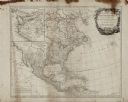
| Date: | 1790 |
|---|---|
| Description: | An updated and corrected version of Robert de Vaugondy's 1750 map "Amérique Septentrionale: Dressée sur les Relations les Plus Modernes des Voyageurs et Na... |

| Date: | 1783 |
|---|---|
| Description: | This map is hand-colored and shows the boundaries of British, Spanish, and the newly recognized American claims, as well as the fishing rights granted to F... |
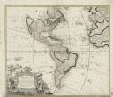
| Date: | 1746 |
|---|---|
| Description: | Detailed map of the western hemisphere and part of Africa and Europe. Islands, cities, settlements, rivers, lakes, countries, and regions are marked. Mount... |
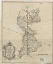
| Date: | 1780 |
|---|---|
| Description: | This map portrays North and South America at a very unusual angle, with north oriented towards the upper right corner. Colonies, Native American land, a fe... |

| Date: | 1759 |
|---|---|
| Description: | Map of North and South America showing regions, colonies, cities and settlements, rivers, lakes, and Native American land. Near the bottom left an inset ma... |
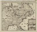
| Date: | 1719 |
|---|---|
| Description: | This extremely detailed and ornate map shows the cities, Native American land, mountains, lakes, rivers, and European claims of North America. An inset map... |
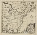
| Date: | 1747 |
|---|---|
| Description: | Map of America showing rivers, lakes, mountains, and regions, but primarily focusing on the French and Native American settlements along the Mississippi th... |
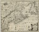
| Date: | 1758 |
|---|---|
| Description: | Map showing lakes, rivers, cities, Native American land, and the boundaries of French and English claims in America and Canada north of New York. A title c... |
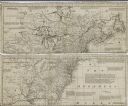
| Date: | 1755 |
|---|---|
| Description: | Map of North America east of the Mississippi River showing cities, settlements, Native American land, mountains, lakes, rivers, and the boundaries between ... |

| Date: | 1763 |
|---|---|
| Description: | Map of America and part of Canada including the borders of European claims after the French and Indian War. Cities, forts, Native American lands, rivers, l... |
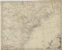
| Date: | 1776 |
|---|---|
| Description: | Map of the American colonies and land east of the Mississippi River. Prominent cities, forts, Native American land, mountains, rivers and lakes are all sho... |

| Date: | 1776 |
|---|---|
| Description: | Map of North America east of Mexico showing important cities, the colonies, regions, Native American land, mountains, lakes, and rivers. A series of lakes,... |
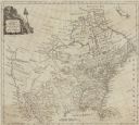
| Date: | 1770 |
|---|---|
| Description: | Map of North America showing the boundaries between French, Spanish, and English claims after the French and Indian War. Kitchin includes numerous place na... |

| Date: | 1759 |
|---|---|
| Description: | Map of north eastern Canada and parts of New England, showing settlements, cities, portages, Native American land, mountains, lakes, and rivers. The unusua... |
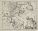
| Date: | 1783 |
|---|---|
| Description: | Map of eastern Canada and part of America, with an inset map of the Great Lakes region in the lower left corner. It shows boundaries, cities, settlements, ... |

| Date: | 1776 |
|---|---|
| Description: | Map showing New England, Nova Scotia, and Newfoundland, based on the seminal work of D' Anville, as well as the works of Belllin and de Vaugondy. It shows ... |
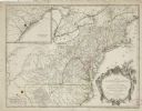
| Date: | 1755 |
|---|---|
| Description: | Map of colonial America, showing the lands north of South Carolina and west of the Mississippi River. An inset map of the Carolinas and Georgia sits in the... |

| Date: | 1720 |
|---|---|
| Description: | Detailed, ornate, and comprehensive map of America from the east coast to present day Texas. Numerous features appear throughout the map, including Native ... |
If you didn't find the material you searched for, our Library Reference Staff can help.
Call our reference desk at 608-264-6535 or email us at: