
| Date: | 1864 |
|---|---|
| Description: | A hand-colored survey map of southeastern Minnesota and Wisconsin, showing the locations of railroads, land grant railroads, land offices, and the 6 and 15... |

| Date: | 03 25 1931 |
|---|---|
| Description: | This blueline print map shows lot and block numbers, additions, churches, and public land in North and South wards as they were in 1884. Towards the top of... |

| Date: | 1897 |
|---|---|
| Description: | This map shows city wards, block numbers, parks, cemeteries, roads, railroads, Lake Michigan, and selected buildings. Also included are indexes to streets,... |

| Date: | 1911 |
|---|---|
| Description: | This map shows city wards, block numbers, parks, cemeteries, roads, railroads, Lake Michigan, and selected buildings. Also included are indexes "Milwaukee ... |

| Date: | 1921 |
|---|---|
| Description: | This map shows various zones in a proposed city ordinance. Also shown are creeks, streets, parks, hospitals, cemeteries, and the Fox River. A legend is inc... |
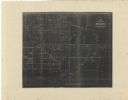
| Date: | 1856 |
|---|---|
| Description: | This map shows township grids, existing settlements, Indian reservations, rivers, lakes, and treaty lines. Included is a portion of Minnesota. Lake Michiga... |
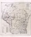
| Date: | 1934 |
|---|---|
| Description: | This map shows the electric transmission lines, cities, and county boundaries. Includes a list of holding groups and operating companies. Caption reads: "M... |
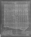
| Date: | 1900 |
|---|---|
| Description: | Map showing a paper city on the shore of Lake Apuckwa (Lake Puckaway) in Marquette or Green Lake County. The map includes certifications signed by John V. ... |

| Date: | 1976 |
|---|---|
| Description: | Intended for tourists, the front of this guide includes twelve county bicycle maps and text. The reverse includes four maps of state trails and nine maps o... |
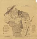
| Date: | 1938 |
|---|---|
| Description: | This map shows "regional designation problem areas" and "nature of problem or solution." The left margin has a key showing the problem areas. The right mar... |
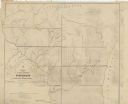
| Date: | 1851 |
|---|---|
| Description: | A survey map of Wisconsin and eastern Minnesota, with the township surveys for portions of the Saint Croix region in progress. The maps also show the Meno... |
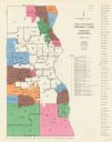
| Date: | 1965 |
|---|---|
| Description: | A map of Milwaukee County showing the county supervisor districts and the city wards. The map also includes the names of those on the on the board of elect... |
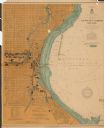
| Date: | 1907 |
|---|---|
| Description: | This map is a chart of Milwaukee Harbor that displays local streets, bridges, roads, railroads, public buildings, businesses, factories, dry docks, parks, ... |

| Date: | 1776 |
|---|---|
| Description: | Fairly detailed map of New York City and parts of Long Island. It shows streets, roads, wharves, ferries, ship yards, Fort George and the battery, public b... |
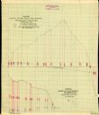
| Date: | 1903 |
|---|---|
| Description: | This map is ink on printed paper reading: "standard profile plate." "Surveyed Oct. 15, platted Dec. 15, 1903 ; surveyed May 9, platted Dec. 9." |
| Date: | 1904 |
|---|---|
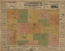
| Description: | Map shows townships and sections, landownership and acreages, roads, railroads, post offices, and farms. On the top, bottom, and sides of map are advertise... |

| Date: | 1889 |
|---|---|
| Description: | This map shows a plat of city, city limits, numbered blocks, numbered lots, wards, local streets, roads, railroads, street railways, fire limits, hydrants,... |

| Date: | 1898 |
|---|---|
| Description: | This map shows city wards, block numbers, parks, cemeteries, roads, railroads, Lake Michigan, and selected buildings. Also included are indexes "Milwaukee ... |

| Date: | 1900 |
|---|---|
| Description: | This map shows city wards, block numbers, parks, cemeteries, roads, railroads, Lake Michigan, and selected buildings. Also included are indexes "Milwaukee ... |

| Date: | 1901 |
|---|---|
| Description: | This map shows city wards, block numbers, parks, cemeteries, roads, railroads, Lake Michigan, and selected buildings. Also included are indexes "Milwaukee ... |
If you didn't find the material you searched for, our Library Reference Staff can help.
Call our reference desk at 608-264-6535 or email us at: