
| Date: | 1775 |
|---|---|
| Description: | This map shows the northern Pacific Ocean along with north eastern Asia and western North America. The interior of Asia contains detailed engravings of pla... |
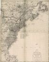
| Date: | 1777 |
|---|---|
| Description: | This detailed map of the American colonies shows cities, villages, roads, mountains, lakes, rivers, swamps, counties, state boundaries, and Native American... |

| Date: | 1772 |
|---|---|
| Description: | Map of the north west portion of America and Canada, as well as a small section of eastern Russia. Lakes, rivers, Native American land and the occasional ... |
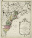
| Date: | 1776 |
|---|---|
| Description: | Map showing the English claims in America at the outbreak of the Revolutionary War. Lotter labels each of the thirteen colonies (both in the map and in the... |

| Date: | 1776 |
|---|---|
| Description: | Map showing New England, Nova Scotia, and Newfoundland, based on the seminal work of D' Anville, as well as the works of Belllin and de Vaugondy. It shows ... |
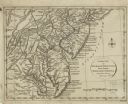
| Date: | 1778 |
|---|---|
| Description: | Detailed map of the Chesapeake Bay region and surrounding states. It shows a detailed account of the borders, cities, towns, islands, swamps, mountains, ri... |

| Date: | 10 1776 |
|---|---|
| Description: | Broadside map showing the British invasion of New York city in August and September of 1776. The map shows important cities, forts, roads, hills, mountains... |

| Date: | 02 1777 |
|---|---|
| Description: | Map depicting the campaigns of October and November 1776, in Manhattan, Westchester, and part of New Jersey, published only a few months after the conclusi... |
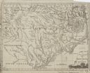
| Date: | 1779 |
|---|---|
| Description: | Map of North Carolina showing counties, cities, towns, chapels, courthouses, Quaker meeting houses, forts, mountains, swamps, inlets, lakes, and rivers. A ... |
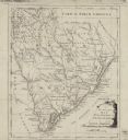
| Date: | 1779 |
|---|---|
| Description: | Map of South Carolina showing boundary lines, Native American land, precincts, townships, cities, towns, forts, roads, mountains, hills, swamps, islands, a... |
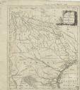
| Date: | 1779 |
|---|---|
| Description: | Map of colonial Georgia showing cities, towns, Native American land and towns, forts, roads, trading paths, islands, mountains, swamps, and rivers. Annotat... |
If you didn't find the material you searched for, our Library Reference Staff can help.
Call our reference desk at 608-264-6535 or email us at: