| Date: | 1939 |
|---|---|
| Description: | This nine-part map from the U.S. Bureau of Public Roads identifies federal and state highways in Wisconsin by pavement type. County, forest, park, and publ... |

| Date: | 1872 |
|---|---|
| Description: | Birds-eye drawing of Eau Claire depicts street names and street locations, houses, trees, bridges, piers, canals, railroads, and the Chippewa and Eau Clair... |

| Date: | 1944 |
|---|---|
| Description: | This nine-part map from the U.S. Bureau of Public Roads identifies federal and state highways in Wisconsin by pavement type. County, forest, park, and publ... |

| Date: | 1950 |
|---|---|
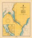
| Description: | This map of Sturgeon Bay is part of the survey of the northern and northwestern lakes. The map shows lights, railroads, roads, and some public buildings. R... |

| Date: | 1900 |
|---|---|
| Description: | This map shows a paper city located on Swan Lake in Columbia County. It includes lot and block numbers, two public squares, and two little lakes of "good w... |

| Date: | 1902 |
|---|---|
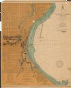
| Description: | This map is a chart of Milwaukee Harbor that displays local streets, bridges, roads, railroads, public buildings, businesses, factories, dry docks, parks, ... |

| Date: | 1907 |
|---|---|
| Description: | This map is a chart of Milwaukee Harbor that displays local streets, bridges, roads, railroads, public buildings, businesses, factories, dry docks, parks, ... |

| Date: | 2000 |
|---|---|
| Description: | This map shows the industrial area along the Menominee River and canals. Industrial buildings are shown in orange and labeled in red. Other areas are shown... |

| Date: | 1878 |
|---|---|
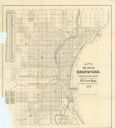
| Description: | This map shows block numbers, wards, roads, railroads, parks, and selected buildings and includes a "Milwaukee city street guide" as well as a guide to pub... |

| Date: | 1950 |
|---|---|
| Description: | Subject: "TD-24 — Pipe Lines." Where Taken: "SW." Information with photograph reads: "TD-24 superior pipe boom owned by H.C. Price Company, Bartlesville, O... |

| Date: | 1831 |
|---|---|
| Description: | Map of the city of Louisville, Kentucky on the Ohio River showing streets and numbered lots. The Ohio River, Corn Island, and the Louisville and Portland C... |

| Land Speculator and Politician |
|---|
| Brief biography of surveyor, land speculator, railroad promoter and politician Byron Kilbourn, twice elected mayor of Milwaukee. |

| Brief history of the Fox and Wisconsin River Improvement Company. |

| Wisconsin's First Scientist |
|---|
| Read about Wisconsin's first scientist. Learn about his achievements; including his scientific writings, and his work as an engineer and land surveyor. |
If you didn't find the material you searched for, our Library Reference Staff can help.
Call our reference desk at 608-264-6535 or email us at: